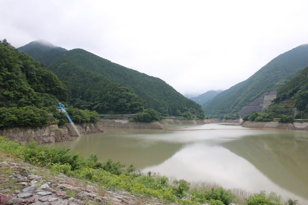
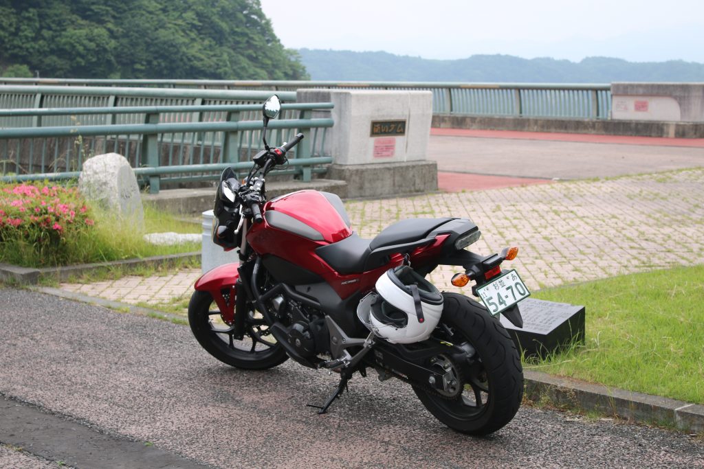
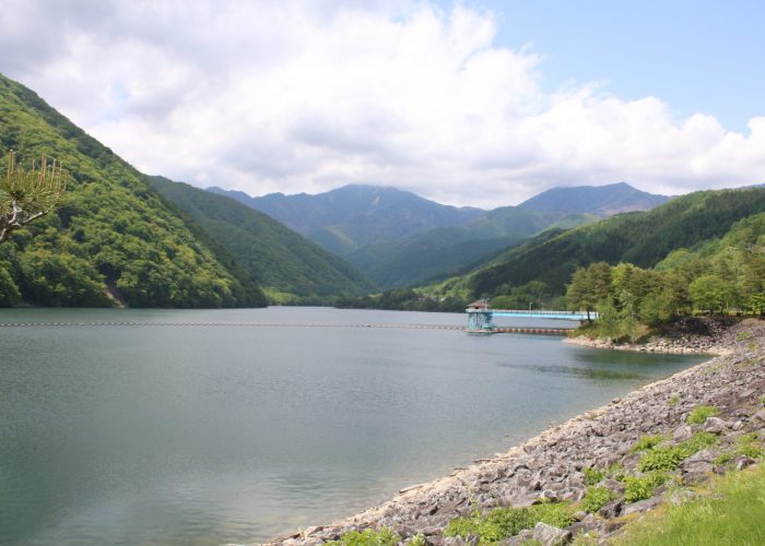
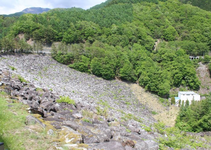
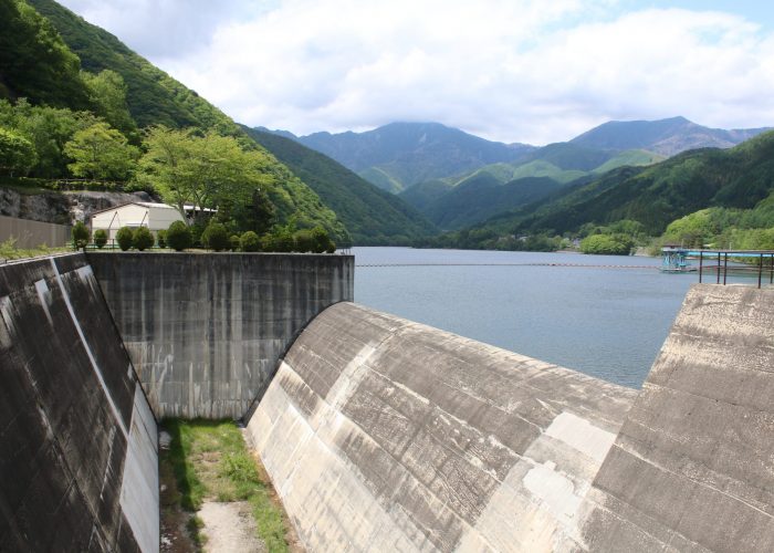
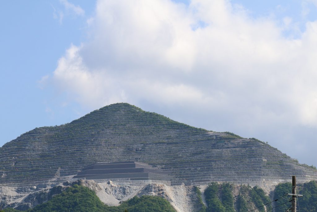
ダムや海、山、川、岬を巡るツーリングを通し関東を主に日本の風景を紹介します

Author: seasons-japan-admin (Page 1 of 3)

The most detailed impression of NC750S

Design  ★★★★    The design around the front can be improved.
Engine  ★★★★   It’s enough on general roads.
( More 10 to 20 ps is wanted on tall roads)
Brakes  ★★★    The rear one is a little weak.
Usability ★★★★   The luggage space is supurve.
The position of the filling port can be improved.
Economy ★★★★★  The economic price and the small fuel consumption
are terrific
Price   ★★★★★  ABS, ETC, Grip heaters are equipped by default.

Let me introduce the most detailed impression of NC750S. NC750S is not so popular around the world, but a lot of fascination as a motorcycle can be found as well as the other motorcycles. I will report the most detailed impression of the design, the riding, the convenience, the usability, the packaging, and the interesting point about the mechanical design.
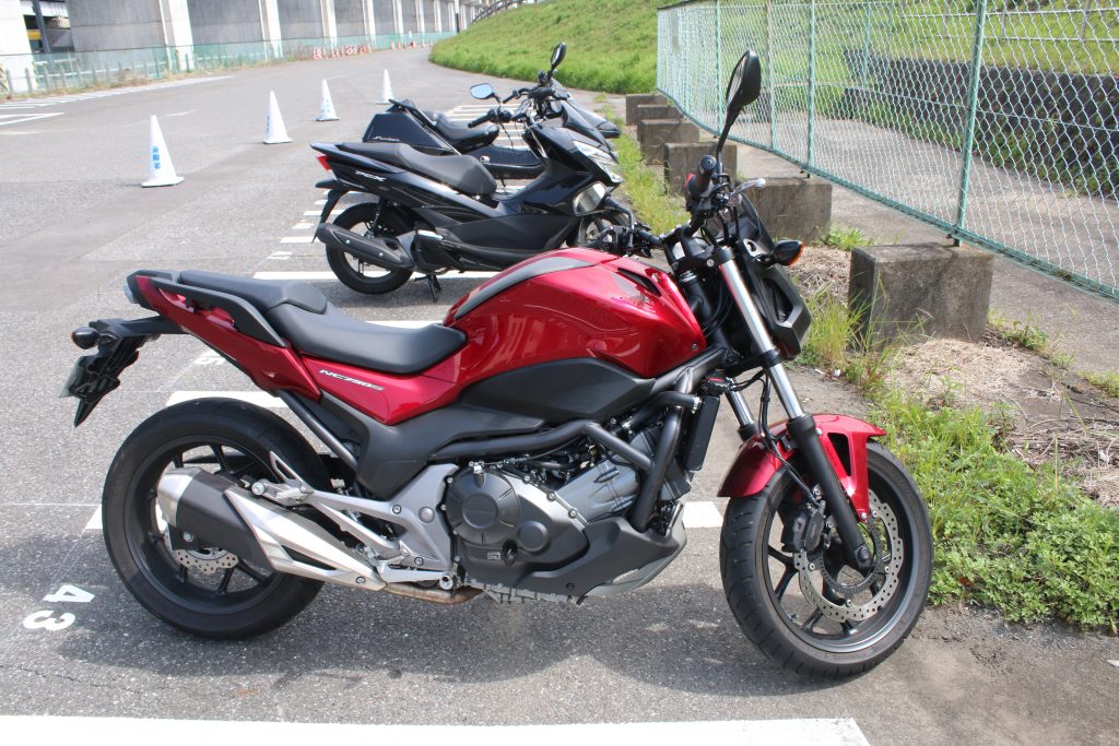
NC750Sを右側からみる
この写真だけでもNC750Sの特徴が沢山みてとれます

Overview of NC750S

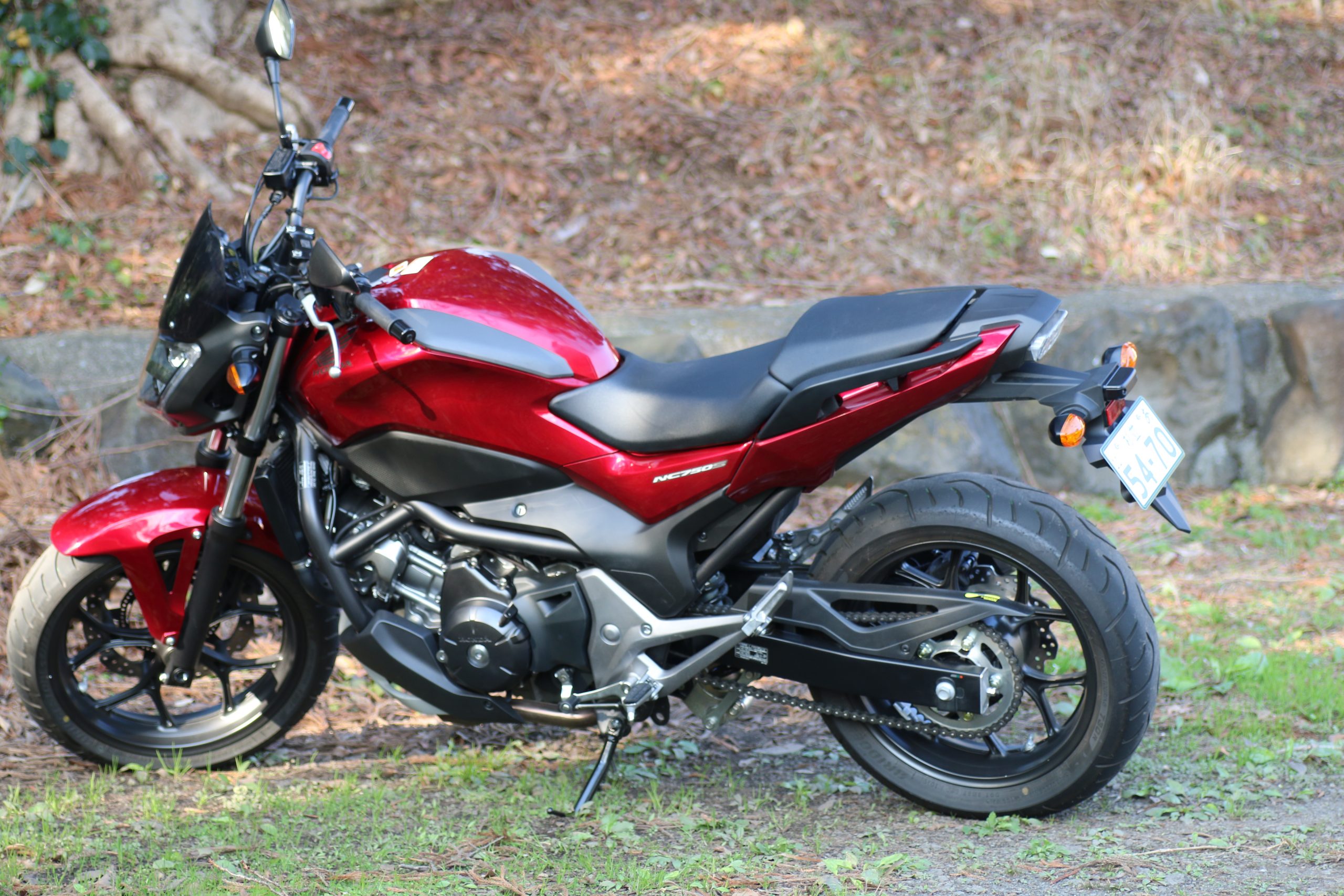
The 2,215mm overall length is a little long and characteristic. This is a result of a little large fork angle 27°. The height of seat is 790mm and I can stand on the full soles of the both foot.
The engine 62° forward tilted looks remarkable. A diamond frame is applied and you can see the main frame in the comparatively lower position, how do you like? The design around the engine, the rear suspension, and the exhaust muffler is well combined and preferable. On the other hand, the design around the front looks a little cheap.

The low style is characteristic and this effect the riding.

NC750S engine impression
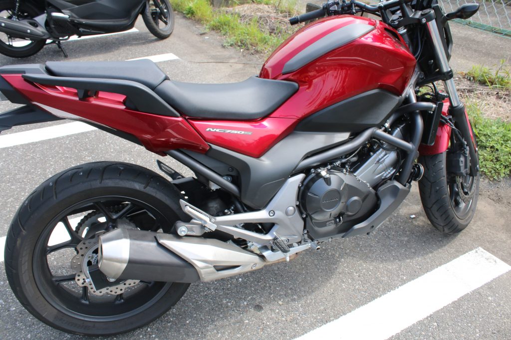
NC750Sシートエンジン周り
最近のバイクにしてはエンジンからリアサス周りが忙しい印象です

The engine of NC750S is a water cooled, 4 stroke, OHC, 4 valves, and parallel 2 cylinders. Someone said it has been designed by dividing the engine of a HONDA car, FIT into 2 parts. Maximum power is 54ps /6,250 and you can understand the low rpm characteristic. The engine of FIT has been already DOHCed, and the engine of NC750S looks one for a car than the engine of FIT.

The maximum power is remarkably lower than that of the other same class motorcycles and this is because NC750S is not so popular. Slow? No. When I ride on a winding road in ordinal velocity, I am satisfied with the characteristic of the engine. In riding on the winding with many curves, the domain the torque arises is very useful and the characteristic is very suitable.

Of course, I feel some dissatisfaction in some case. When I ride on a tall road on which the limited speed is 120km/h (about 75mph), I felt a desire for more 10-20ps power if I will pass the other. There is no problem but I have to accelerate intentionally to obtain the acceleration.

The exhaust sound feels me the power which is produced by a typical parallel 2 cylinders, probably because the design of the system of the intake and the exhaust are excellent. The muffler setting aims the low sound like ‘a big motorcycle’. I can ride in a residential area without an anxiety about the noise.

The impression of brakes of NC750S
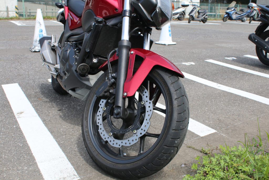
NC750S フロントブレーキ周り
NC750S フロントブレーキはシングルディスクのABSです。

The front and rear ABS are equipped with all models of NC750S after Nov. 2018. The front brake is single disk produced by NISSIN and I have been satisfied with the performance. If you ride on a circuit full braking needed, you may feel some dissatisfaction due to the weight, but once I ride on a public road there is no problem.
The performance is enough but I think the timing the ABS is applied is a little too early. 2 years has been passed since the duty of equipping ABS, I think something to improve is still left with the ABS of NC750S.
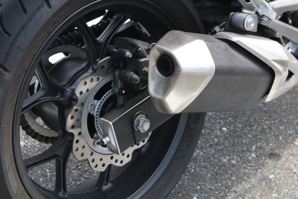
NC750S のリアブレーキ周り
NC750Sのリアブレーキはフロントディスクの内側から打ち出されたものだそうです

The rear brake is a single disk produced by NISSIN. The disk is stamped from the inside of the front disk to decrease the cost… I want more capability. I wander if my riding style may be wrong, the rear does not work in the deceleration in middle-high velocity and only the front works. Of course in low velocity, the rear works.

The impression of the luggage space of NC750S
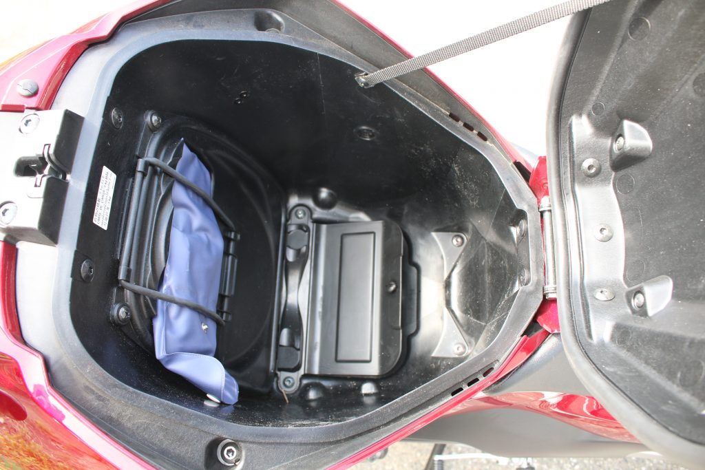
NC750s ラゲッジスペースの内部
NC750s ラゲッジスペースの内部には車載工具とETCユニットが入っています。

The luggage space in the position of the fuel tank is the special of NC750S. Almost all motorcycles have no space for a luggage, the space is extremely convenient. When I ride, small luggage like a camera or a drink PET bottle can be stored and at the destination I will go activities after converting my helmet and the luggage. A large size helmet ( like a racing type ) can not be stored in the space, but my Arai Quantum J is just suitable.

An ETC ( the tall road payment system with a credit card ) is equipped in the bottom of the luggage space of the Japanese model of NC750S. It is a little inconvenient to set the ETC card to the system every time. I do not know the models for the other countries. Some review says the latch does not be fasten well, but do not mind. The latch will be fasten if you weigh on the top of that by your weight.

The space is tank shaped but consists of resin not of metal. The bags which sticks by the magnets are not available. OK, I do not need. The heat from the engine effect the inside of the luggage and it is preferable to keep a hot coffee in a PET bottle. On the other hand, a cool drink becomes warm quickly and food souvenirs have to be avoided to stored in.

I wrote various points about the luggage space, the conclusion is the space is enormously convenient.

The impression of the position of the fuel filling port of NC750S
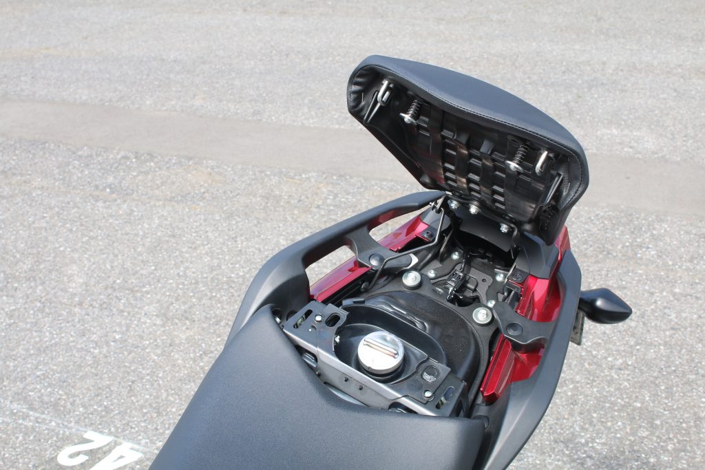
NC750S 給油位置
タンクが通常のタンク位置にないということは給油位置は…タンデムシートの下です

The usual tank space is replaced by the luggage space and the fuel filling port is set under the pillion. An attendant who do not NC750S will be surprised ( ,because in Japan an attendant fills fuel at a half of petrol station. ) This is an unique feature but it is sometimes inconvenient. When I have luggage on the pillion, I have to remove them before filling fuel. And the depth of the tank is a little shallow and some carefulness is needed not to spill fuel.

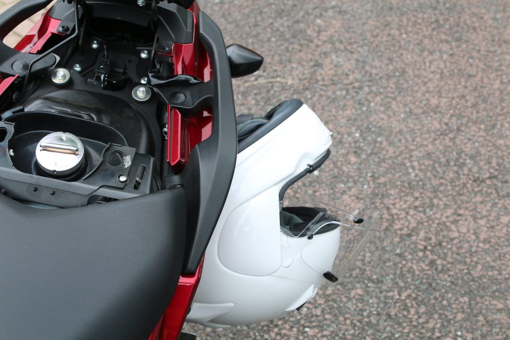
There is a hook for the helmet holder. The wire helmet holder which has loop on its both end is included in the equipped tools. ( The tools can be found on the front wall of the luggage space. ) To use, put a loop through the D ring of helmet, put the loop through another loop, pull the loop below the pillion grip, and hang the loop to the hook. After these, once you lock the pillion, helmet is never stolen.
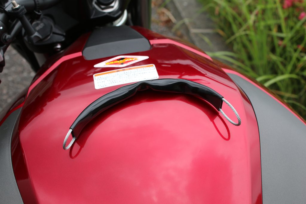
ヘルメットホルダーのワイヤー
工具袋に入っていて意外と気づきません
ヘルメットホルダーを使ってみた
NC750Sの独特のヘルメットホルダー

The impression of luggage hook on the pillion grips of NC750S
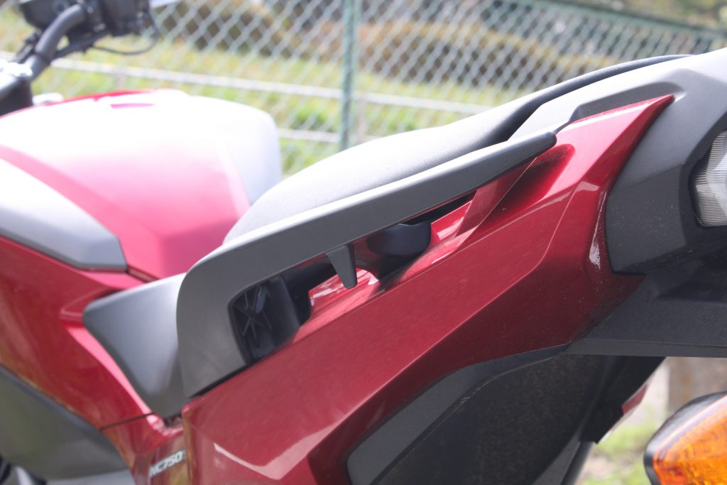
NC750S タンデムグリップとラゲッジフック
NC750S タンデムグリップとラゲッジフック。ラゲッジフックは何故か1か所しかありません

Only one luggage hook provided on a pillion grip. When I use touring net that have several hooks, it is very inconvenient. Though hooks of a touring net can hang on the groove on the pillion grip, the size of the groove is a little small and shallow.

Luggage like a small souvenir can be easily put on the wide pillion and the grips. Large luggage like a camping gear is required to fix tightly with a large touring net and in this case I have a little problem.

The impression of NC750S as an engineer

NC means ‘New Mid Concept’ consists of ‘the usability in the street ride and the touring’, ‘the middle class which is comfort with superior fuel consumption’, and ‘high cost performance’. NC700 series were released in 2012. And NC750 series were released with the enlarged displacement of 745cc.

To realize the concept, the luggage space and RC70E with parallel 2 cylinder, OHC engine are proposed. Of course the luggage space is convenient and at the same time effect the design and characteristics of NC750S. To build the luggage space, the main frame is off set to low in the front and risen up in the rear. I can imagine that ( it is usual in this time ) a lot of structural simulations had been executed to design the complex shape.

And to secure the space for the luggage, the engine is tilted largely (62°). This is because the fork angle is large (27°). The fuel is usually stored in the tank, but the space is used as luggage space and the fuel is replaced to the place under the seat. As the result of these, NC750S has the long over all length ( longer than CB1300 Super Four ) and the low weight center. So the design looks like a ‘sport type’ but the riding characteristics is a ‘cruiser’ with high stability. NC750S is a new proposal of the new style of motorcycle as the result of pursuit of the New Mid Concept from HONDA .

The price is very economic and I appreciate the proposal from the engineers of HONDA.

The reason why NC750S does not so popular

In Japan NC750S is used for the big motorcycle license training. ( In Japan, when you take license you have to ride prepared motorcycle by the driving and riding school. ) This is the reason that displacement of NC700S was enlarged to 750cc. ( A motorcycle which has larger displacement than 700cc must be used in lessons and test for the big motorcycle license by the law. )

NC750L ( de-powered version of NC750S for the lessons) is riden by a lot of rider who has the normal motorcycle license in practice. Probably most of them feel ‘power is weak?’ because the power of NC750L is only 27[37]/5,250. This value is of course smaller than other motorcycle whose displacement is 250-600.

The setting ( for the engine, the transmissions, and the position of weight center) of NC750L and NC750S is so different that I can feel the difference easily. In Japan, NC750S is sometimes recognized as a derived version of NC750L which has weak power and this is the reason NC750S does not become so popular.

But the situation in other country are different. The fact is, the convenience, the easiness to ride, and the reasonable fuel consumption are not so attractive for the majority of riders, though they are remarkable advantages in fact. And NC750S does not have ‘history’ or ‘story’ on which the brand is based.
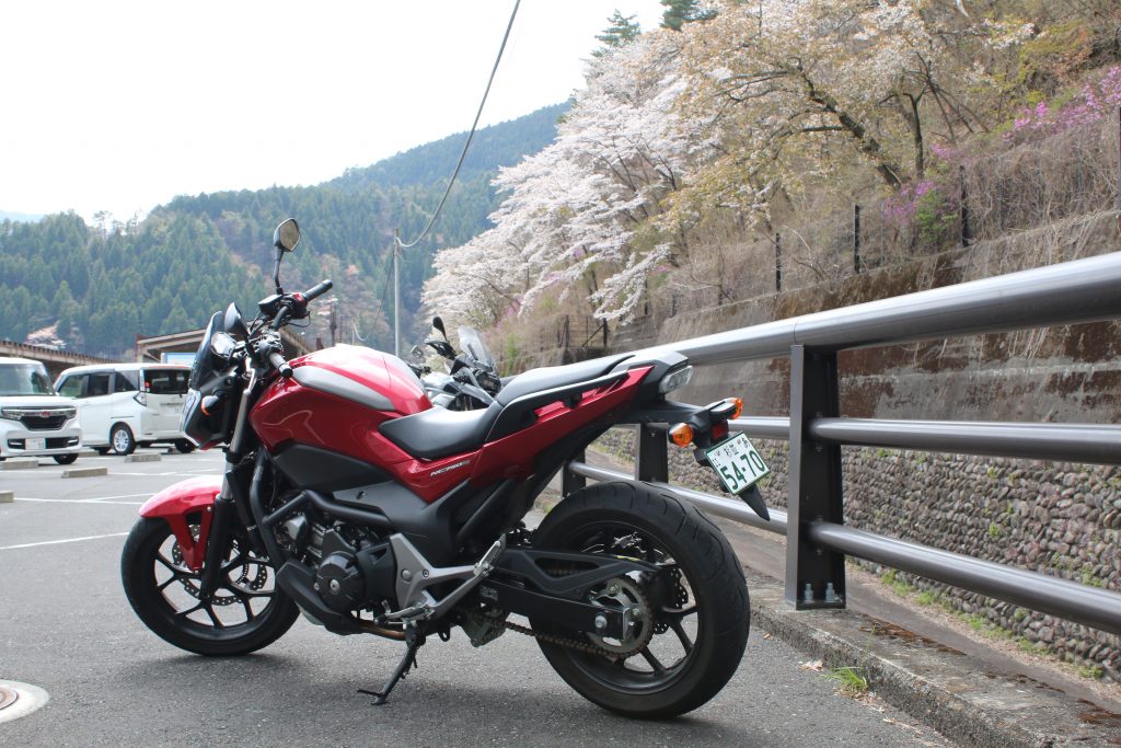
NC750Sとヤマザクラ、三つ葉ツツジ
都内某所で撮影したNC750S。前傾したストロークの長いエンジンが特徴的。

The attractions of NC750S

is the performance that enable me to go touring with ease and to ride on a winding road with fun. The fundamental pleasure, ‘ riding and enjoying all direction landscape with feeling wind ‘ is realized in a higher order by NC750S.

The engine power of NC750S is lesser than that of CB650F which has less displacement. The displacement of engine of NC750S, RC70E is used to increase the torque in low rpm and this method is not usual in a concept of motorcycle engine, but is usual that of a car ( especially sedans ) engine. This realizes the stable and tireless riding and eases a long distance touring. In a long distance touring, I often ride throughout a day and tiredness could cause an accident. The stability and easiness of NC750S provide ‘safe’.

Of course riding on the winding road with NC750S is pleasure. Though NC750S can not race with a supersport or a highend machine ( the most biggest problem is my riding skill ) , I can enjoy riding on a winding road. Passing a curved road banking the body moderately is pleasure satisfyingly. The maximum power is a little low but the power in low rpm is powerful due to the displacement. I think once a skillful rider rides on a tight winding road, NC750S is the fastest.

The economic price is based on the clear concepts. The low rpm oriented OHC engine consists of lesser parts and essentially economic. And, because it exhausts lesser NOx and sounds smaller, the cost for the exhaust system can be reduced. Front and rear brake is single disk ( is real single disk because rear one is stamped from inside of front disk ), but on the other hand ABS is equipped in all model to make sure of security. If you feel this packaging is cheap you can select another motorcycle. But I think it is exquisite.

The fuel consumption is over 30km/l ( about 70mpg ) . So I fill NC750S with fuel after one day touring ( about 300km ) on public road. The fuel consumption is very economic among this class of motorcycles.

I love my NC750S which makes my weekend pleasure!
3 Dams a Day( ARIMA Dam, FUTASE Dam, KAKKAKU Dam )Touring- Part of FUTASE Dam

This story is continued from the part of ARIMA Dam. I rode on route 140 through route 299 to get to RAIDENTODOROKI Bridge ( so called loop bridge). Beyond the bridge I get to TAKIZAWA Dam. The entrance for FUTASE Dam. is CHICHIBU side than TAKIZAWA Dam and I seemed to overlook the entrance. The sign on route 140 does not say ‘FUTASE Dam’ but ‘CHICHIBU Lake’. I recommend you to be careful when you will go to the dam, but you usually will not overlook if you use car navigation system.

Arrival at FUTASE Dam

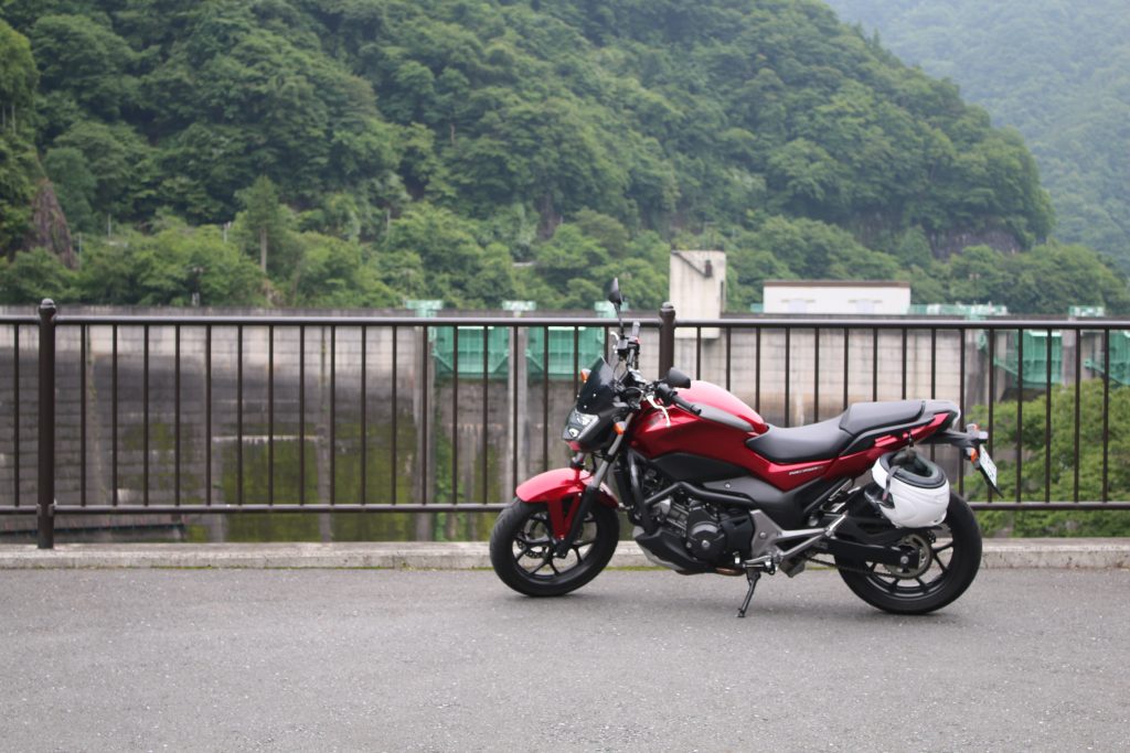
二瀬ダム前でNC750Sを撮影
Though the handrail bothers, beyond that is cliff.

You can get to FUTASE Dam by a little ride from route 140 to pref. road 278. The rest park served as also an observatory is available. The parking is enough large but the equipment and shops around look old. The dam is completed in 1961, it is natural that they are old if they had been built at the same time.

The Beautiful Arch of FUTASE Dam

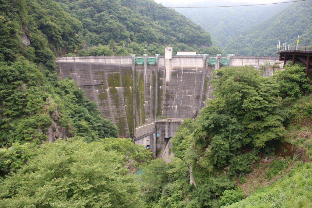
二瀬ダムを展望所から望む
A little dirty and ivy laid body is the characteristics of FUTASE Dam.

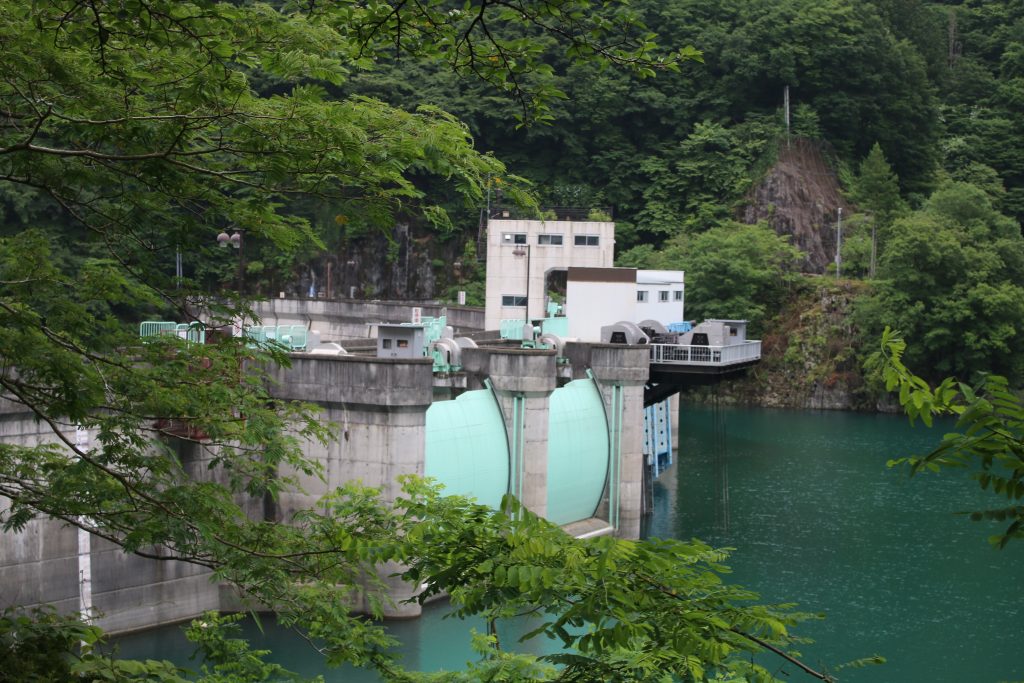
FUTASE Dam had been realized as a concrete arch dam when it had been completed. The arch is beautiful and the design is so different from that of URAYAMA Dam or TAKIZAWA Dam ( the both is a concrete gravity dam) . The parking is located in front of FUTASE Dam on the left side of pref. road 278 and you can reach MITSUMINE Shrine through the road on the dam.

Though the dam had been realized as an arch dam, recently it is realized as an arch-gravity dam. The design of the dam never changed but the classification is updated and variegated.

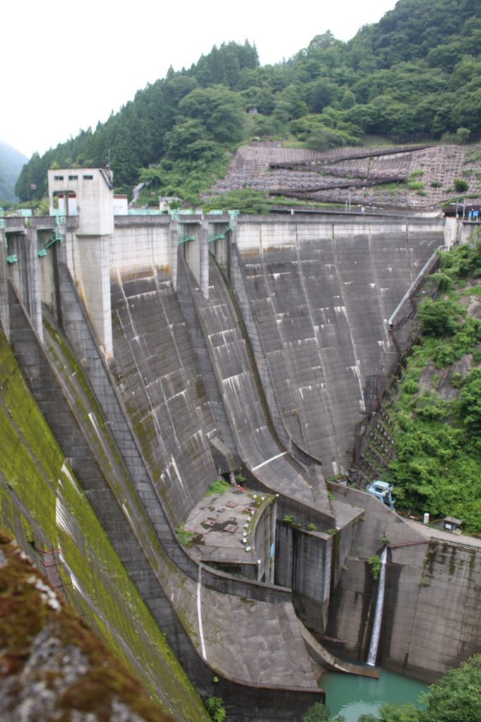
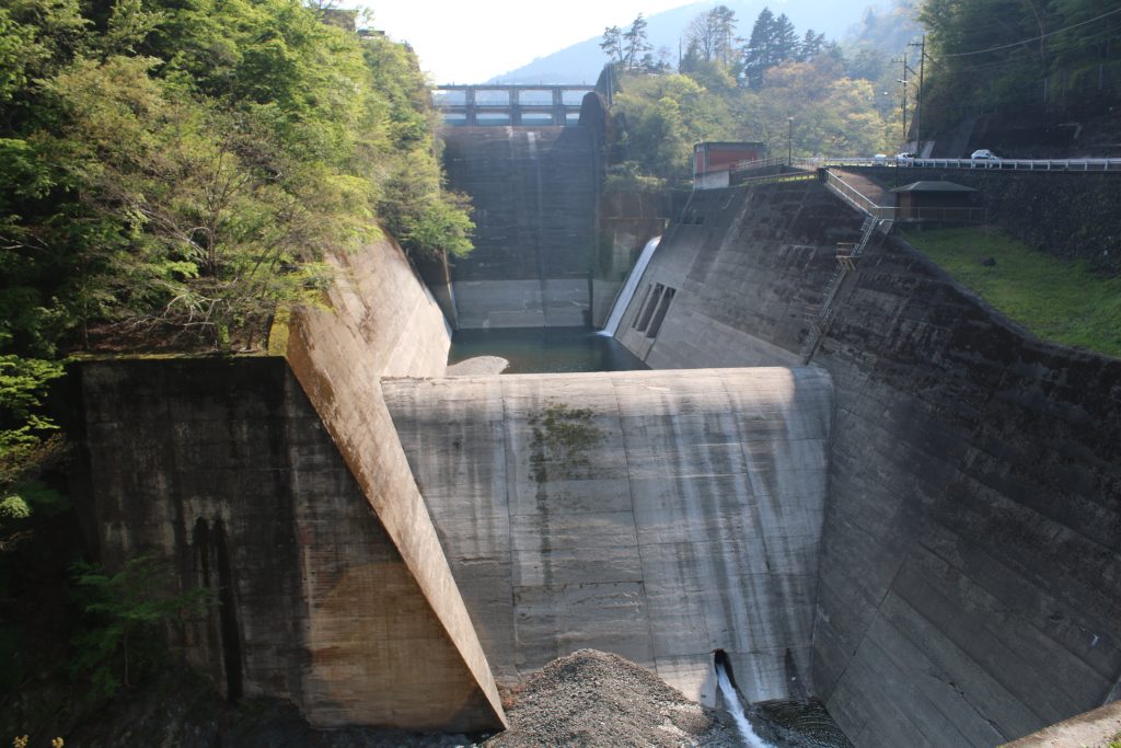
二瀬ダムの堤体を右岸から望む
The shape of the spill way like a ski jumping slope is characteristic.

Pref. road 278 on the dam is served as a one way, alternative traffic by the signal timing. So the waiting time of the signal is longer than usual, but it is in order. Actually, the top of the dam is narrow and cars can not cross each other. The signal must be followed.

The photo above was taken from the right bank of the dam. The ski jumping slope shaped spill way is very characteristic. The main purpose of FUTASE Dam is flood control but at the same time power plant is operated. The power plant is built under the ski jumping slopes. You can find the zigzag fold in the photo. The pavement has been equipped there and you can see the dam from bird’s eye view.

The Beautiful Arch of FUTASE Dam

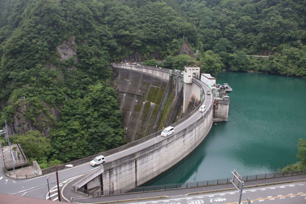
二瀬ダムの美しいアーチ
The beautiful arch of FUTASE Dam

The photo above was taken from the observatory on the left bank of the reservoir. Pref. road 278 stretches on the arch shaped top of the dam. The landscape that edge of dam body seems to penetrate the rocky mountain is powerful and impressive. On the top of dam, more cars run than I imagined because there is the famous shrine, MITSUMINE Shrine through pref. road 278 to mountain side.

二瀬ダムの洪水吐
The gates of spill way are also arch shape.

The gates of spill way are also arch shape and it is interesting. I would like to take more photos but it started to rain and the way to KAKKAKU Dam was left. I left FUTASE Dam for KAKKAKU Dam to complete 3 dams a day touring.

To be continued to the part of KAKKAKU Dam.

3 Dams a Day ( ARIMA Dam, FUTASE Dam, KAKKAKU Dam ) Touring – part of ARIMA Dam

The Solo touring for 3 dams a day

Someday, I was planning the solo touring for FUTASE Dam and KAKKAKU Dam. I found that I can visit ARIMA Dam if I rode metro road 53rd ( OME-CHICHIBU line ) from IKUSABATA, in front of OKUTAMA to CHICHIBU. I decided to take the way and started the 3 dams a day touring. Though I selected the way according to my taste, the way from OME on metro road 53rd is the shortest way.

I arrived at ARIMA Dam

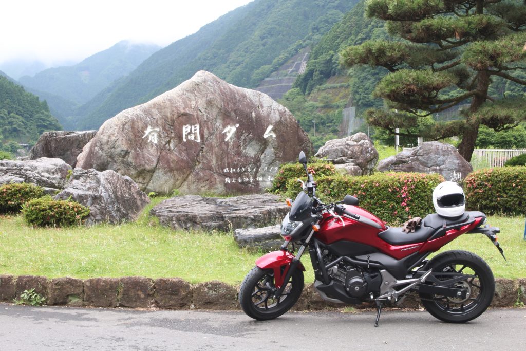
有馬ダムの前でNC750Sを撮影
Taking photo of NC750S in front of the monument says ‘ARIMA Dam’

There is ARIMA Dam near from halfway of metro road 53rd. You can get there without losing the way. The monument say ‘ARIMA Dam’ stands on the side of the road and can be found easily. The first, I took the photo. The reservoir of ARIMA Dam is named ‘NAGURI Lake’. Behind NC750S, though it is hidden by alpenroses, the monument says ‘NAGURI Lake’ stands.

ARIMA Dam is the first Dam Saitama Pref. Administrates

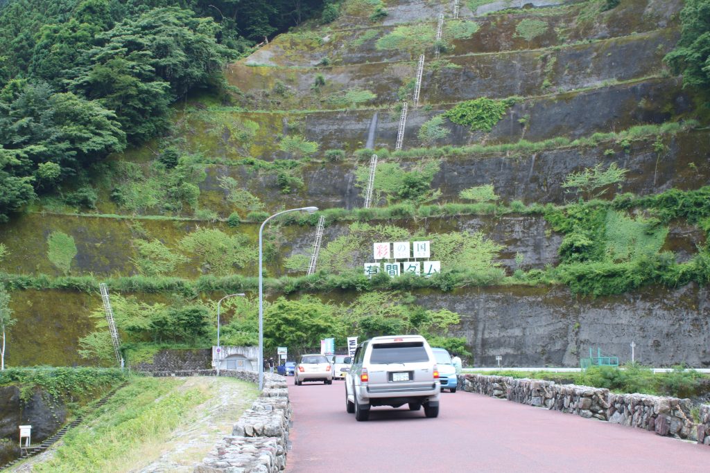
彩の国 有間ダム
The top of ARIMA Dam is a normal road.

ARIMA Dam is completed in 1986 and is administrated by SAITAMA Pref. SAITAMA Pref. manages 2 dams, ARIMA Dam and KAKKAKU Dam in 2020. ( The web page of SAITAMA Pref., the sluice of GONGENDOU Balancing Pond is picked up. But the height of the sluice is lower than 15m, and I do not count it as a dam. ) The sign in the photo above says ‘State of SAI ( SAI means ‘colorfulness)’ and that emphasizes the fact the dam is managed by SAITAMA Pref.

ARIMA Dam is a Rock-filled Dam with the Central Impervious Zone

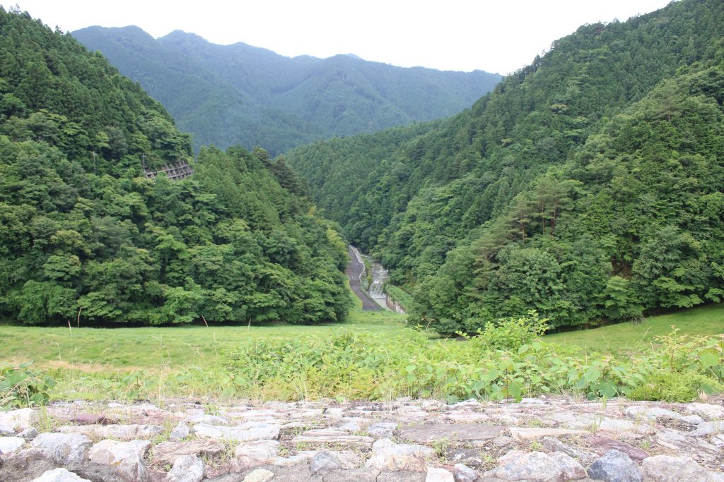
有間ダムの堤体と下流側
単なる山にしか見えませんがダムの堤体です

The photo above is taken from the body of ARIMA Dam from the top of the Dam. When the glass grows on the body of the dam, the body of the dam looks like just a hill or a mountain. The characteristics of ARIMA Dam is that the dam almost do not have mechanical equipment and water is released naturally from the spill way once the water level is over that. I am sorry that I forgot to take photo of the spill way and I have to do in the next chance. The way left is long and I returned to metro road 53rd. to CHICHIBU.

The spill way is beyond the blue structure in the left side.

The Road Station FRUIT PARK ASHIGAKUBO is my routine rest place

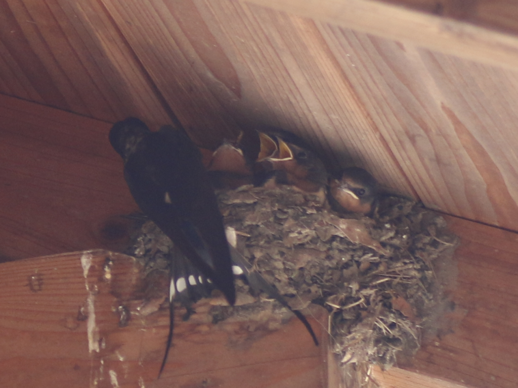
道の駅芦ヶ久保で出会った燕の親子
The road station FRUIT PARK ASHIGAKUBO where I had taken the photo of swallow that flied and turned quickly. I found a swallow cares it’s children.

There is the road park FRUIT PARK ASHIGAKUBO on the beside of route 299th near the merging point with metro road 53rd. The parking is spacious and the landscape with clear stream is my favorite. I remember that I took photos of swallows when I took rest there. They had complete their nest and work hard to care their children. The parent gathered the food and feed the children. It seemed it takes a little more time to grow the children to fly. The parents are always working hard for their children.

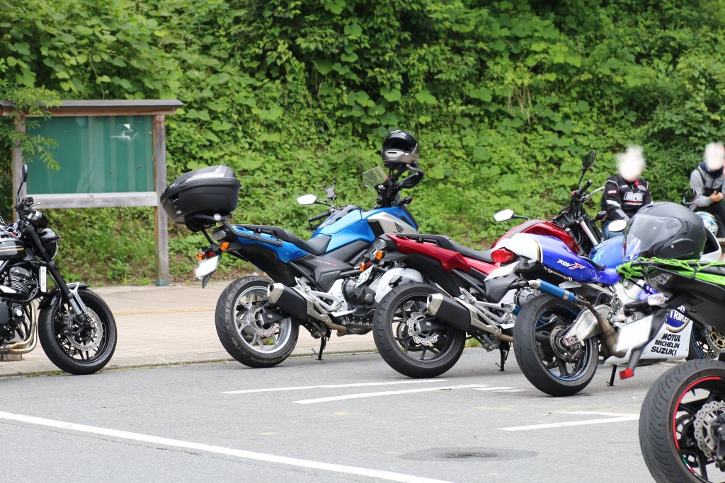
NC750SとNC750X
The red one is my NC750S. Beyond that NC750X, the brother of NC750S was parked.

A lot of motorcycle was parked in the parking. NC750X, the brother of NC750S was parked. You can find that the design is alike each other and that of the rear is same. RGVΓ( probably ’96 type ) was parked and I think if the blue Lucky Strike paint was novel when I write this blog.

After this, I left for FUTASE Dam. To be continued.

Solo-touring for URAYAMA Dam and TAKIZAWA Dam in CHICHIBU ( ver. TAKIZAWA Dam )

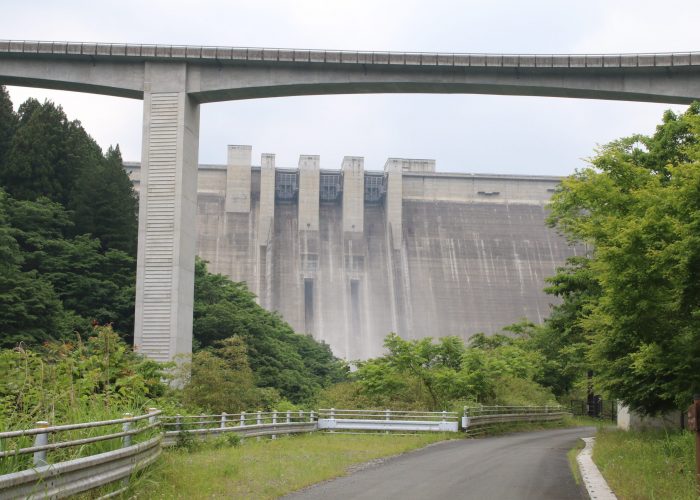
This blog is continued from the blog about terrible cherry fish. The road beyond the terrible cherry fish was … terminated. I returned on the same way to route 140 and headed for TAKIZAWA Dam. CHICHIBU side of TAKIZAWA Dam on route 140, FUDOTAKIFUKINHIROBA ( the Park Around FUDOTAKI Fall ) is there. There, you can see the body of TAKIZAWA Dam clearly. I parked NC750S there and took some pictures around.

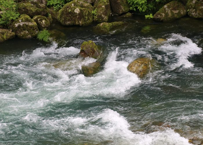
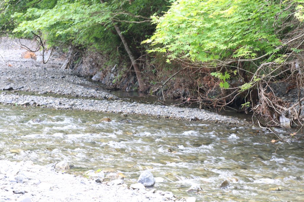
  • 滝沢ダム下流の中津川
    清流ではありますが、激流の一歩手前です。
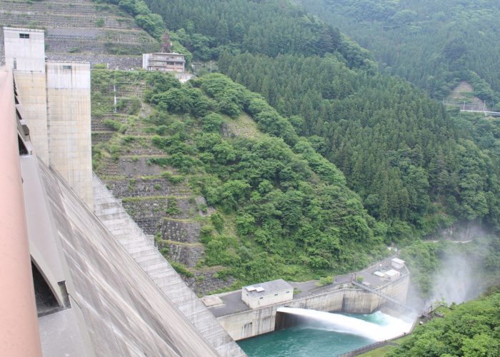
  • 滝沢ダムとループ橋
    滝沢ダムの堤高を国道140号線で登るために巨大なループ橋がかけられました
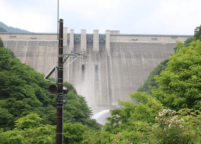
  • 放流中の滝沢ダムを下流側から望む
    ダム堤体の下側がやや霞んでいるのは放流の水しぶきの影響です

In this season, water may be released and the down flow of the dam is almost a white-water than a clear mountain torrent. The landscape you can see the dam body through RAIDENTODOROKIBASHI ( Bride on the Thundering Torrent, usually called the Loop Bridge ) is very characteristic. When I got near the body of the dam, I could find the water-release far. The pavement has been constructed around there but that was closed due to the effect of COVID-19.

I left the park for the body of TAKIZAWA Dam through the Loop Bridge. You can see the picturesque landscape on the bridge but parking on the bridge is prohibited and I could not take pictures. I recommend you to go there and experience the landscape.

The superb view from the body of TAKIZAWA Dam

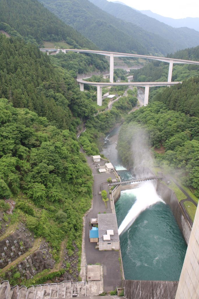
滝沢ダムからループ橋を望む
滝沢ダムから下流側を望むとループ橋の全容が分かります

The photo above is the superb view from the body of TAKIZAWA Dam. The height of TAKIZAWA Dam is a little lower than URAYAMA Dam introduced former. But the length of the dam top is wider and the dam has the almost same volume of reservoir. TAKIZAWA Dam and URAYAMA Dam have the almost same scale and are so-called ‘high dam’. The design looks alike probably because they were planed in the same 1970’s. ( But the completion of constructing TAKIZAWA Dam was later than that of URAYAMA Dam. ) The operation of TAKIZAWA Dam has been started in 2011.

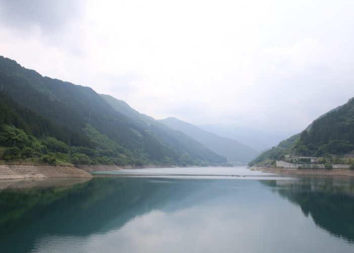
  • 滝沢ダムのダム湖
    このダム湖は奥秩父モミジ湖と命名されています。
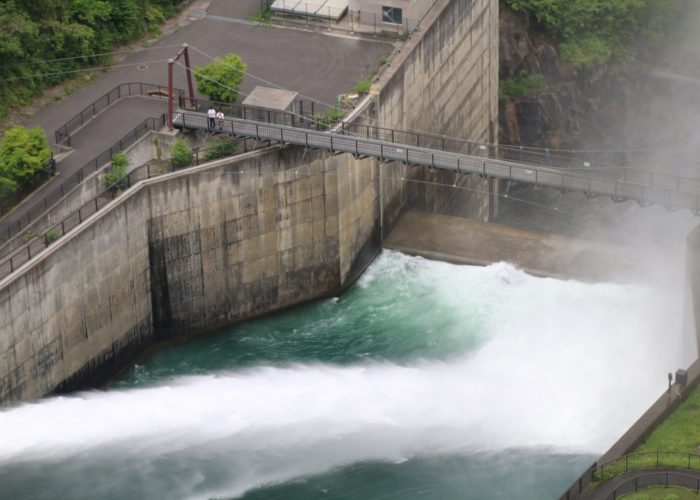
  • 滝沢ダムの放流とつり橋
    滝沢ダムの通常吐とつり橋が見えます
  • つり橋と放水と人
    つり橋に人がいます。放水の規模が大きいことがわかります

The special of TAKIZAWA Dam is the dynamic landscape which constructs of artificial object including the Loop Bridge and nature. It is meaning full to see the Loop Bridge, because the Loop Bridge was constructed to provide the road to ascend the height of the dam.

The end of the solo-touring around the high dam in CHICHIBU

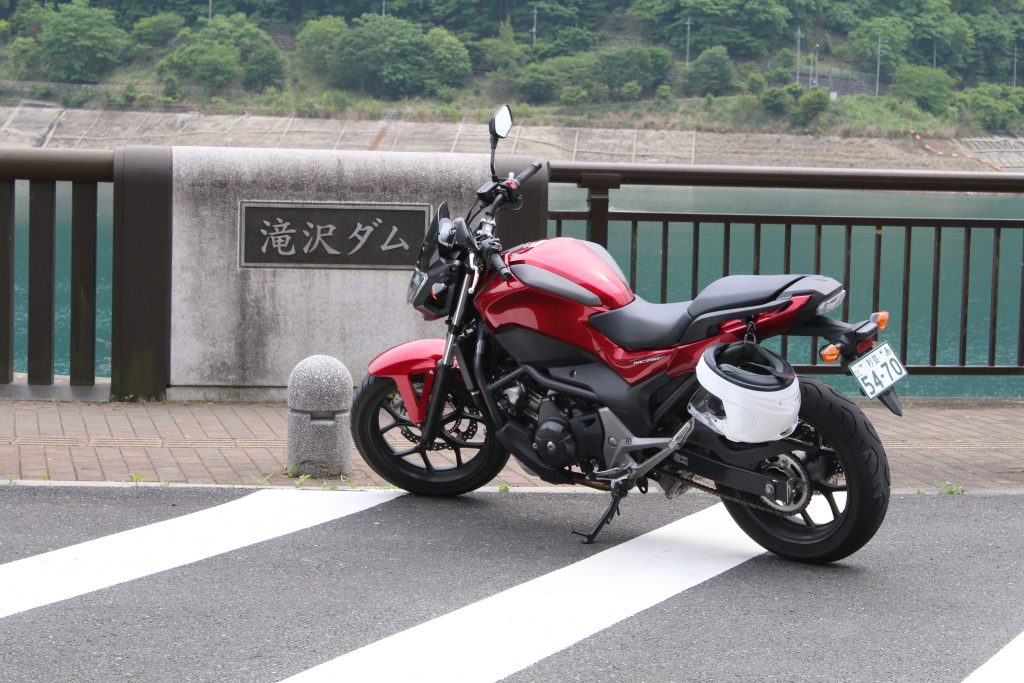
滝沢ダムでNC750S
記念撮影です。付属のヘルメットホルダー使用中。

This day I went to solo-touring around URAYAMA Dam and TAKIZAWA Dam on route 140 to take pictures. It is pity it was a cloudy and rainy day. But the superb landscape of the both dam impressed me.

Next blog, I will present the picture taking touring around FUTASE Dam and KAKKAKU Dam that are near from route 140.

Solo-touring for URAYAMA Dam and TAKIZAWA Dam in CHICHIBU( I saw a frightening cherry trout on the side of clear stream! )
After visiting URAYAMA Dam, I rode for NAGURI district on the pref road 73rd to the upstream of clear river.

浦山川の上流
浦山川の上流はこの時期新緑が美しい渓谷です

The upstream of the URAYAMA Dam is URAYAMA Riv.

The clear stream in the photo above is URAYAMA River. There is CHICHIBU SAKURA Lake, the reservoir of URAYAMA Dam in the downstream of the river. Along the river, google map says the pref road 73rd stretches to NAGURI but the road is terminated beyond URAYAMA Mountain River Fishing Center.

A kappa enjoys fishing

河童が釣りしてる!
河童が釣りしてるけどその先は?

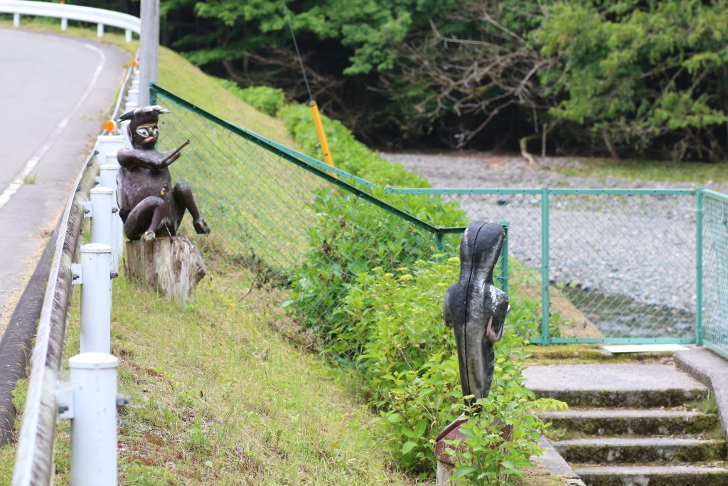
I found various kind of objects when I rode on the pref road 73rd along URAYAMA Riv. Beside of the stair to the river, a kappa is enjoying fishing. Do you know ‘kappa’, an imaginary life lives in the river. He is sitting on a stump of a tree and using a fishing rod in the photo above. What is his target in front of him. I got off NC750S and park on the side of the road and watch the object from the stair…

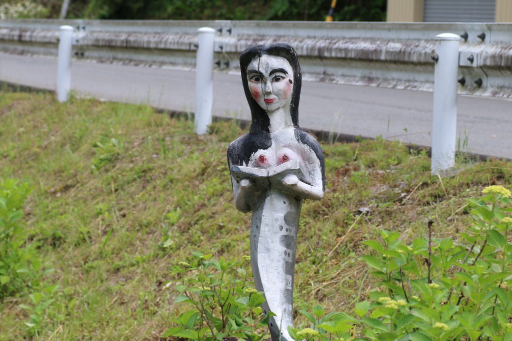
A frightening… cherry trout.

恐ろしいヤマメ
乳房も目立ちますが、本を読んでいる風なのが気になります

…Oh, what? The impact of viewing first was so strong that I could not understand what it is. The characteristic stripes on back of the object remind me that she is a cherry trout. A cherry trout is called ‘山女魚(yamame)’ in Japanese. ‘山’ means ‘mountain’ and ‘女’ ‘a woman’, ‘魚’ ‘a fish’, respectively. The objects presents a kappa is fishing a cherry trout. When I took the photos it was closed season for fishery but in the season the site around there are famous as good points of torrent fishing. But I would not like to fish the cherry fish…

I rode back to Route 140 on pref road 73 and headed for TAKIZAWA Dam. To be continued.

Solo-touring for URAYAMA Dam and TAKIZAWA Dam in CHICHIBU(episode until URAYAMA Dam)

Someday, I rode for solo-touring to URAYAMA Dam and TAKIZAWA Dam in CHICHIBU. I took TOKOTOZAWA Street to Route 299 and got to Route 140. There is the entrance of URAYAMA Dam after a little ride on the north side of Mt. BUKO on Route140. First, I rode according to the sign that says ‘The downstream park of the dam’ to find a good looking bridge…

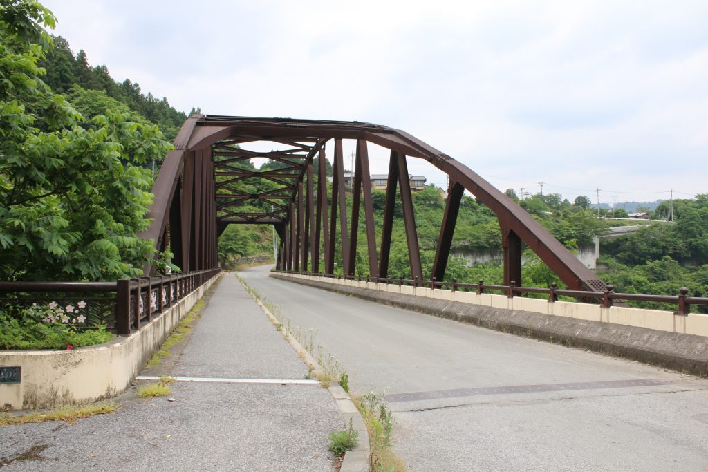
浦山ダム下流の橋
ダムの撮影に最適な橋があります

The second highest in Japan

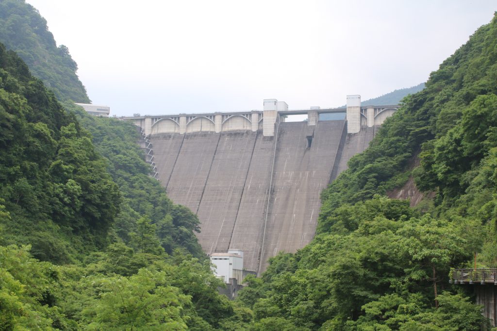
浦山ダムの堤体
浦山ダムの堤体を下流側から望む

I saw the body of URAYAMA Dam in the upstream direction of the river. ‘Huge!’ was the first impression. To tell the truth I imagined a small dam because the word ‘URAYAMA’ means the mountain in back of a home. And it is also the reason that the dam is very near from town area of CHICHIBU ( about several kilometers long ) . The height of URAYAMA Dam is the second highest in Japan as a concrete gravity dam.

The sight from the body of the dam

秩父さくら湖(浦山ダムのダム湖)
浦山ダムのダム湖は「秩父さくら湖」と名付けられています

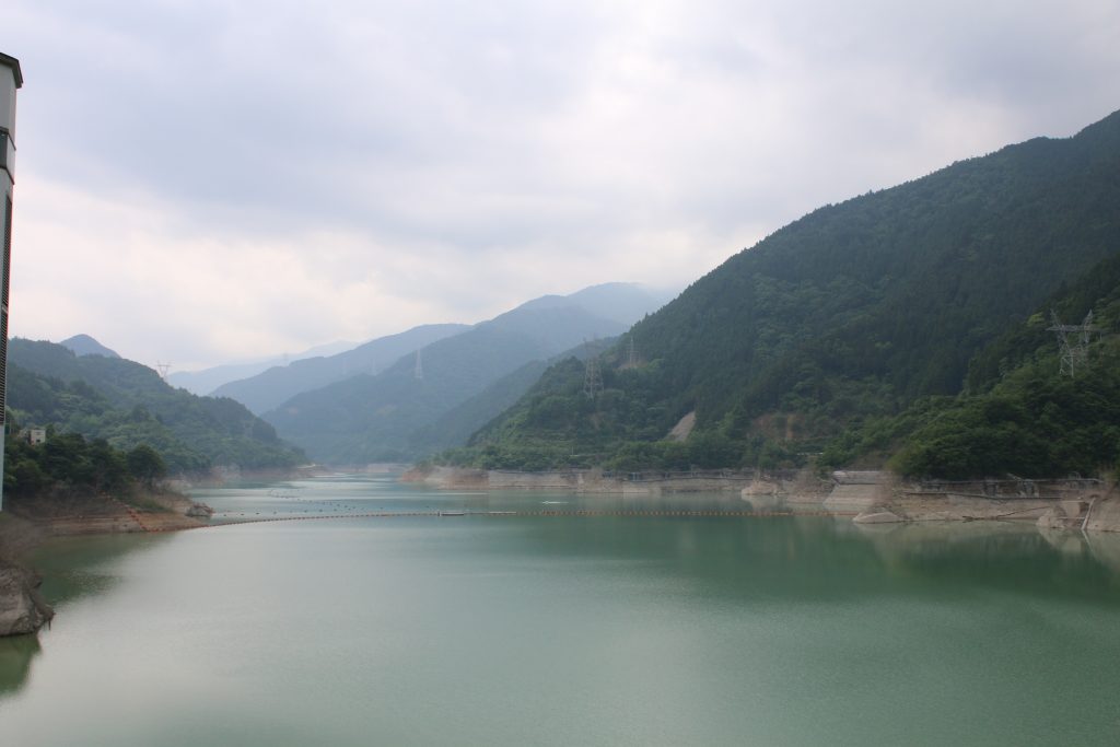
The reservoir of URAYAMA Dam is named as ‘CHICHIBU SAKURA Lake’ (= CHICHIBU CHERRY Lake ). The reservoirs are named ‘NISHICHICHIBU MOMO Lake’ ( = Western CHICHIBU PLUM Lake’ ) for the reservoir of KAKKAKU DAM, ‘OKUCHICHIBU MOMIJI Lake’ ( = BACK CHICHIBU Maple Lake’for the reservoir of TAKIZAWA Dam respectively. They are built on the side of Route 140. On the side of Route 140, FUTASE DAM exists but the reservoir of the dam is named as ‘CHICHIBU Lake’ normaly. Probably FUTASE dam had been constructed in early 1950’s and the impression of the name of the reservoir was not so thought as important.

浦山ダムから市街と武尊方面を望む
手前が秩父市街地、奥には天気が良ければ武尊山が見えるそうです

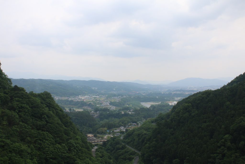
When a fine day, you can see Mt.HOTAKA and NIKKO mountains in the down stream direction from the body of the dam. But it was cloudy and they were hidden by foggy air.

Sculptures for touching are the special of URAYAMA Dam

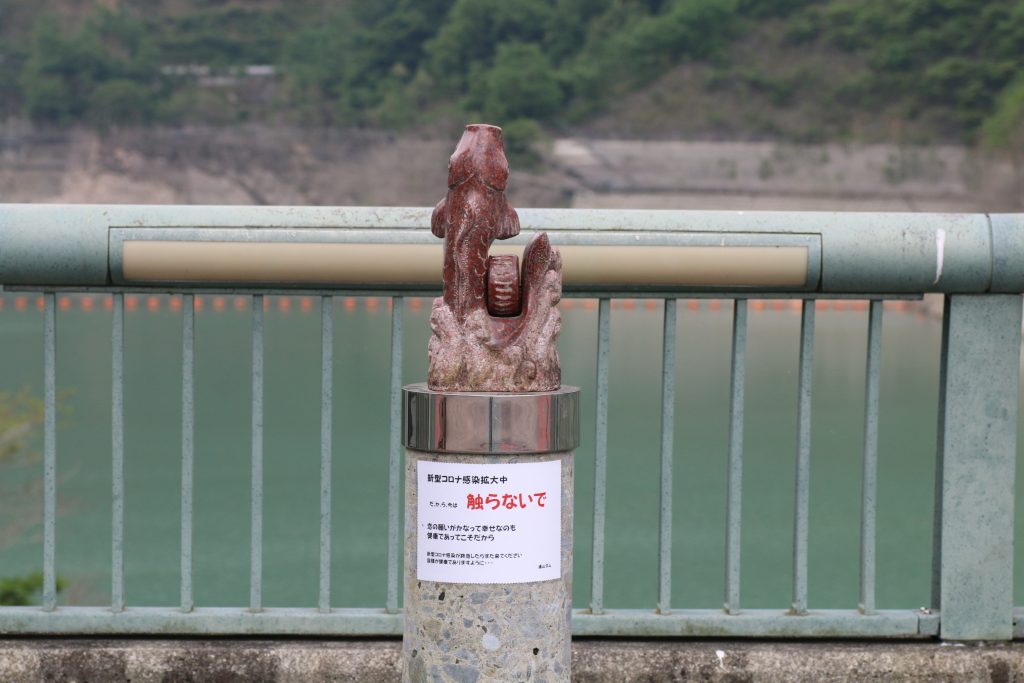
触れない鯉の後生車
触らないで の文字が切ない

The sculptures are the special of URAYAMA Dam according to myself impression. The one of the photo above is ‘KOI NO GOSHOUGURUMA’ ( = GOSHOGURUMA of Carp). In Japanese carp and a love are both pronounced ‘koi’. So this sculpture will make dreams of love come true, if you rotate the cylinder in the right side of the carp once, twice and third time whispering ‘please make my dream of love come true!’. But the red sign says ‘DO NOT TOUCH’ due to COVID-19. You can find other sculptures that make various dreams come true. I recommend you to visit the dam to make your dreams come true.

The design of URAYAMA Dam

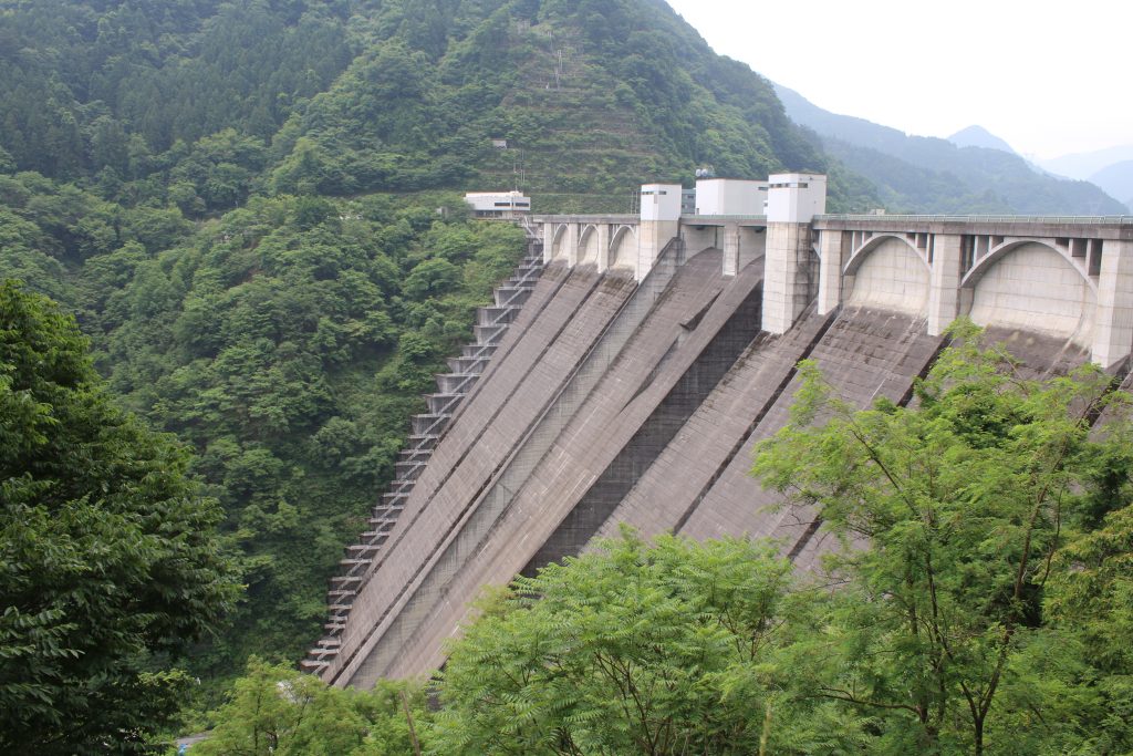
浦山ダムの堤体を側面から望む
浦山ダムの堤体を側面から望む

The most important thing of dam is its practical use. But some ornaments the designer intentionally designed can be seen in a part. The arch shaped ornaments are the characteristic in URAYAMA Dam.

NC750S at URAYAMA Dam

NC750Sの記念撮影@浦山ダム
最近ヘルメットはホルダーに架けてます

I took photo of NC750S. After this, I rode on Pref Road 73 for NAGURI …, the road was terminated. I got back and I changed the destination to TAKIZAWA Dam and the dam touring series started!

Solo-touring on the Route 140 from the FRUIT LINE to HIROSE Dam and CHIHIBU

The both side of the FRUIT LINE was full of young fruit

Someday, I rode for a solo touring from OKUTAMA to KOSHU and through the FRUIT LINE to CHICHIBU on the Route 140. It is said that the longest novel in Japan is ‘DAIBOSATSUTOGE’ and I found the sign says ‘DAIBOSATSUTOGE’ on the way from OKUTAMA to KOSHU. But I did not take the way and rode for the FRUIT LINE.

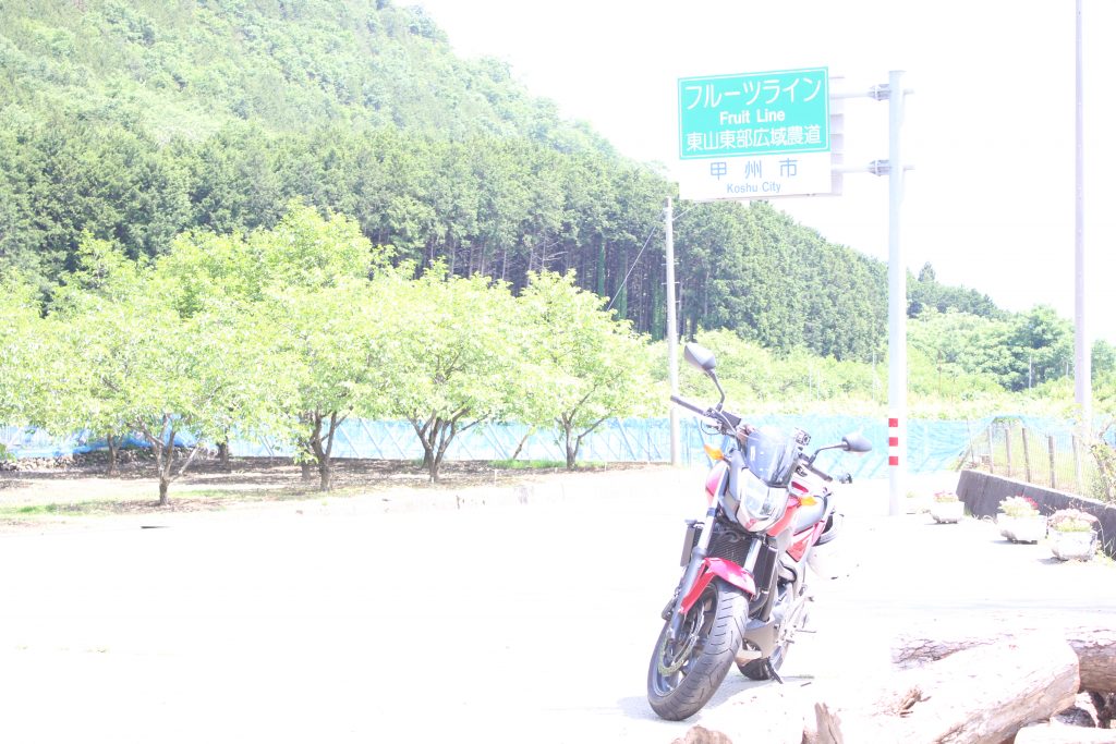
フルーツラインの看板
フルーツラインの周りはその名の通りブドウ、モモの果樹園がです

I took some photos in front of the fruit field beside the FRUIT LINE … I made a mistake of the setting of the camera. As the result, the photo is too bright. In this season, on the fruit fields beside the FRUIT LINE young grapes and peaches are growing.

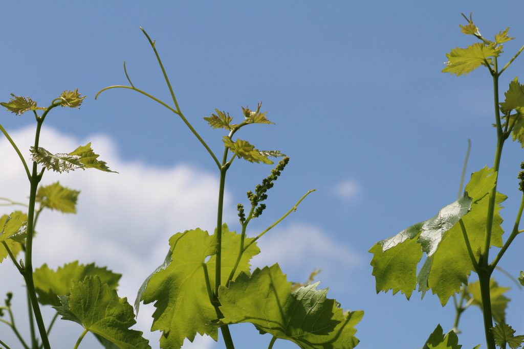
ブドウの芽と極若い実
ブドウの極若い実がついていました。

The sight leafs and ivies of grapes grows into the sky remind me that it is early summer. A pleasure winding road continues from the FRUIT LINE to the Route 140. After riding the winding road, I found the dam body on my left hand side. I took a rest at the dam, HIROSE Dam. A multi purpose dam that YAMANASHI Pref. built and administrates.

The dam body of HIROSE Dam can be seen from the Route 140

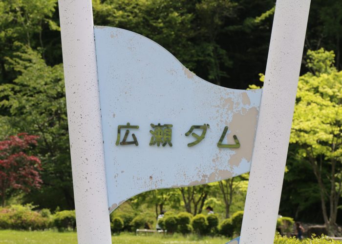
  • 広瀬ダムの看板
    広瀬ダムの看板です
  • 広瀬湖全景
    ロックフィルダムのダム堤体と水+山々のコントラストは絵になります
  • 広瀬ダム下流側の堤体
    下流側のダム堤体は国道140号から見えます。
  • 広瀬ダムの横越流堤
    広瀬ダムは洪水吐に加えて側面に越流堤があるのが特徴です

HIROSE dam plays roles of the flood control, the irrigation, the waterworks and the power generation. The most important motivation of the dam is mainly the flood control. Down stream area of FUEFUKI Riv. is a basin and floods often killed people and damaged the area in the past. They started building the dam in 1970’s and completed in 1980’s. The dam was the first multi purpose dam at the time. Now KOTOKAWA Dam on the same FUEFUKI Riv. system is a multi purpose dam, too.

Mt. BUKO welcame me at CHICHIBU beyond KARISAKA Tunnel

There is the tall gate beyond HIROSE Dam. National route is usually free in Japan and I looked for the charge free route… but I could not found. The free route of the Route 140 is a mountain trail famous as ‘CHICHIBU OUKAN ( CHICHIBU in-outbound). Of course no cars and no motorcycles can pass the route.
On the toll way of the Route 140, KARISAKA Tunnel lays. The length of the tunnel is 6652m and the longest ground tunnel among the national route in Japan. I paid 590 jpy. and rode through the long tunnel to a basin area, CHICHIBU.

武甲山の山容
非常に人工的である意味威容でもあります

I could see the great Mt. BUKO. The mountain had been famous as the symbol of CHICHIBU until the early Meiji era. in Japan. From the middle Meiji era., the limestone mining was started and has been continued. As the result, the sight of the mountain became artificial as seen in the photo above. In KOCHI Pref., there is Mt. TORIGATA that has been curved as well. But I felt something stronger from Mt. BUKO, probably because Mt. BUKO can be seen easily from town area of CHICHIBU. ( Mt.TORIGATA can not be seen from town area. ) The mined limestone has been used as the ingredient of the concrete of buildings in the capital area.

I went home, after taking a rest at the Road Station ASHIGAKUBO and through CHICHIBU-OME line.

Azalea blossoms and swallows at the Road Station ASHIGAKUBO

The Road Station ASHIGAKUBO

Some day, I rode to the Road Station ASHIGAKUBO, CHICHIBU district for solo touring. The road station is beside of the route 299 and in the front of CHICHIBU city from SAITAMA city. Around there is the last mountainous area from the mountains in the western SAITAMA to the CHICHIBU Basin.

道の駅芦ヶ久保の荒川水系
奥が上流 右奥に見えているのが道の駅の建物

Beyond the mountains in the picture is direction to SAITAMA City, and the route 299 stretches in the mountains. The name of the stream is not known but it is one of the upstream of ARAKAWA River. This stream flows west once and reaches the CHICHIBU Basin. And the stream is gathered by ARAKAWA River, flows north to NAGATORO and flows east on the KANTO Plain.

Alpenroses fully blossomed

道の駅芦ヶ久保のヤマツツジ
ツツジには詳しくありませんが恐らくヤマツツジと思われます

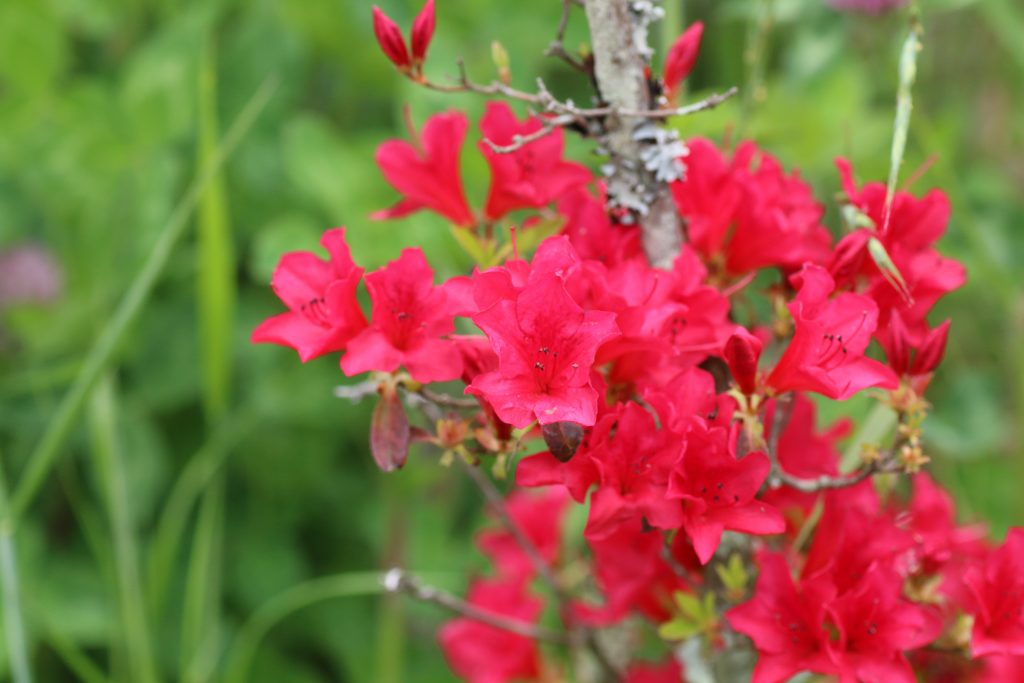
In this season, late spring, alpenroses fully blossomed around the mountain. Though they are very beautiful, the color of flash pink remind me an overwrought passion. And hard looking at the striking pistils and stamens seems to lead me to the world in the flower.

Swallows start the building their nest

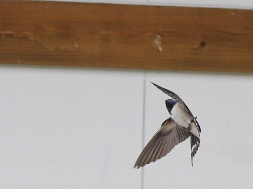
道の駅芦ヶ久保で出会った燕の急旋回
たまたま撮影できたツバメの急旋回

Many swallows flew around. The photo above is luckily taken at the moment of the rapid turn by a swallow. Do not think the pose of the swallow is like a scene in a Japanese kabuki?

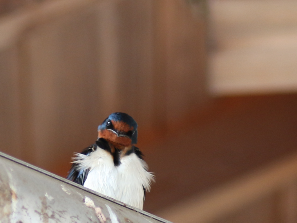
道の駅芦ヶ久保で出会った燕の顔
黒と白と思われているツバメの顔は意外と明るい褐色

The image of swallows are the black body and the white belly. Do you remember their face? Their face is light brown. Have you ever noticed this? They are starting building the nest and were flying to find the place where the nest would be built. I said to good bye to the swallows in the Road Station ASHIGAKUBO, and go home via metro road 53, OME-CHICHIBU line.

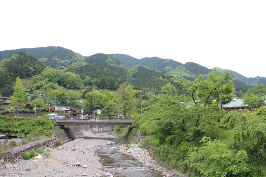
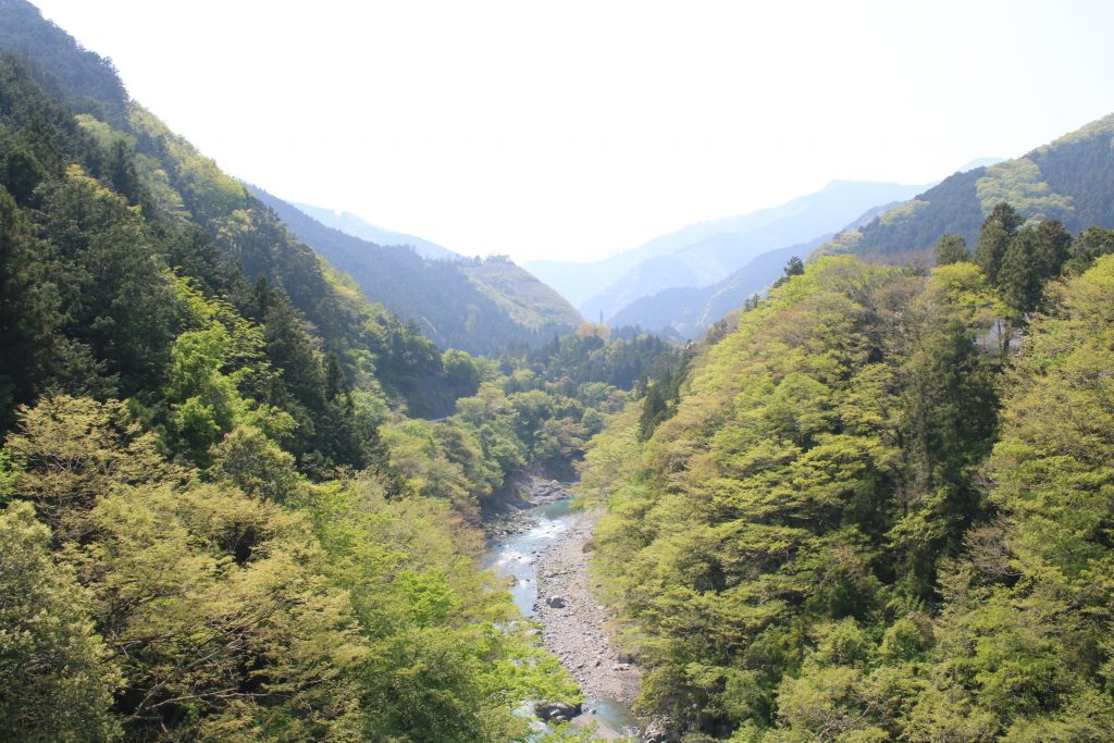
The beautiful landscape of a yellow green valley and wild cherries at OKUTAMA in late spring

Someday, I went for solo touring to OKUTAMA. It was a late spring day and the landscape of a yellow green on a valley and mountains was impressive.

秋川と奥多摩の山々
晩春の芽吹きの萌黄色が印象的です

The river in the picture is AKIGAWA River and the mountains in OKUTAMA can be seen beyond the valley. The valley was beautiful and at the same time the landscape that the mountains overlap each other were impressive. I rode on the route 411 for OKUTAMA and I could see OGOCHI Dam in my left hand side.

小河内ダムの洪水吐
小河内ダムを国道411号線から

From the route 411, the emergency channel of OGOCHI Dam was seen nearly. It was so large that the photo above does not express the scale of the dam. Once I rode beyond OGOCHI Dam, I reached the lake side of OKUTAMA Lake. I found the wild cherries blossom.

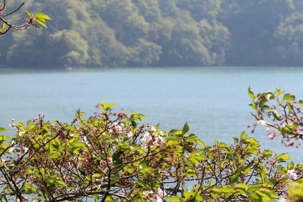
名残のヤマザクラ
晩春、奥多摩名残のヤマザクラ

After I had been satisfied with the yellow green landscape and the wild cherries blossom, I returned home.

The most picturesque sight of Mt. FUJI from BOSO Peninsula

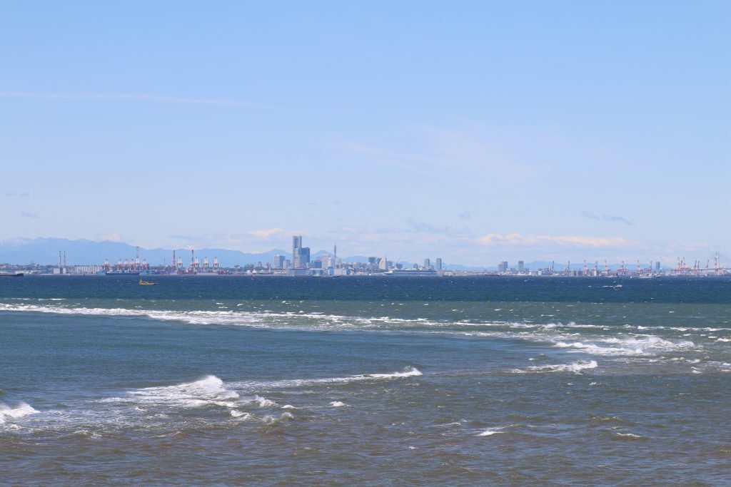
Someday, I went for solo touring to FUTTSU Cape and MYOGANE Cape, BOSO Peninsula, Chiba. It was a very windy day and due to the wind I could see Mt.FUJI from FUTTSU Cape clearly.

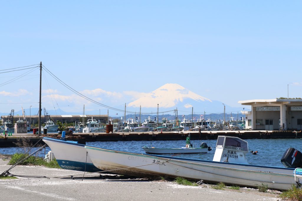
富津漁港から富士山を望む
富津漁港から富士山を望む

From FUTTSU Fishery Port, I could see Mt. FUJI. The port was almost full with fishery boats and pleasure boats. Probably they got a day off work due to the wind. A little beyond the fishery port, I arrived at the observatory on the edge of FUTTSU Cape.

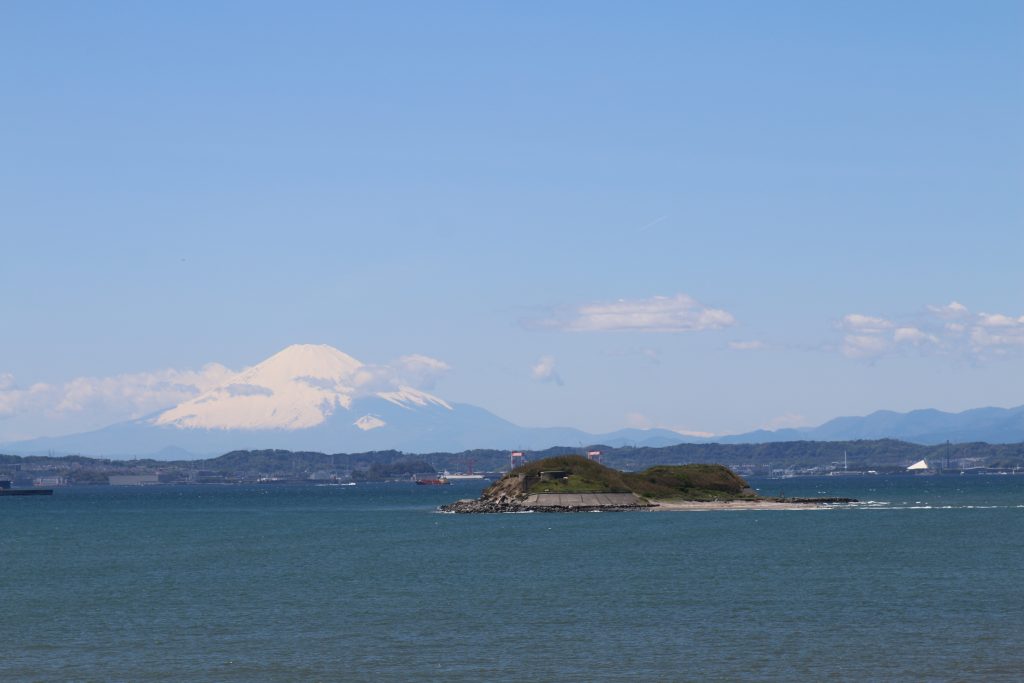
第一海堡と富士山
第一海堡と富士山

From the observatory, DAIICHIKAIHO ( means ‘the 1st sea base’ ) could be seen with Mt.FUJI. The sea base is artificial island built in Meiji era (1868-1912) to defend Tokyo, the capital of Japan. The similar island is ODAIBA in Tokyo. They are ‘brother’ each other, in a sense. In years past, arms were equipped and deployed actually.

富津岬の潮目
富津岬の潮目

When I saw on the sea, I found a clear tideline. FUTTSU Cape divides TOKYO Bay into outside and inside. And this is the reason of the tideline promotion between ebb tide and full time. This environment grows delicious fishes around the cape. OGON-AJI ( golden Japanese jack mackerel ) is a special of in this area. ( Especially in KANAYA, is located near MYOGANE Cape. )

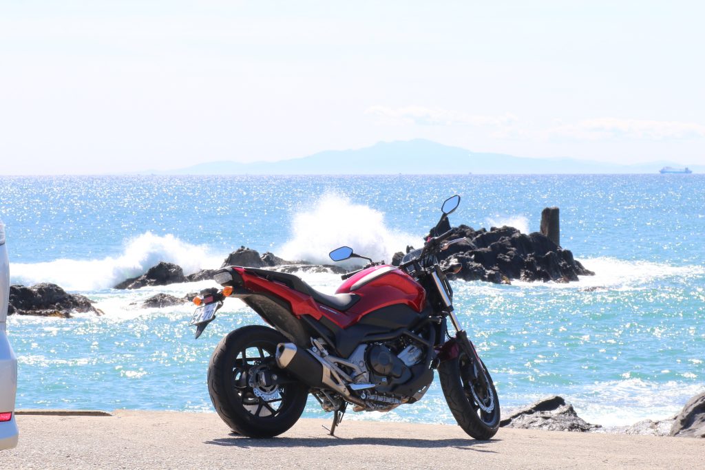
NC750Sと伊豆大島
NC750Sと伊豆大島

When I have arrived at MYOGAME Cape, Mt. FUJI is hidden by clouds but IZUOSHIMA ( IZU Big Island ) could be seen clearly. I took photo of NC750S parking in front of the rock field of MYOGANE Cape. This area is famous as a rock fishing site. The fishing black seabream is very popular in this area and I have tried several times. But I caught no fish… The problem may not be the point but may be my technique.

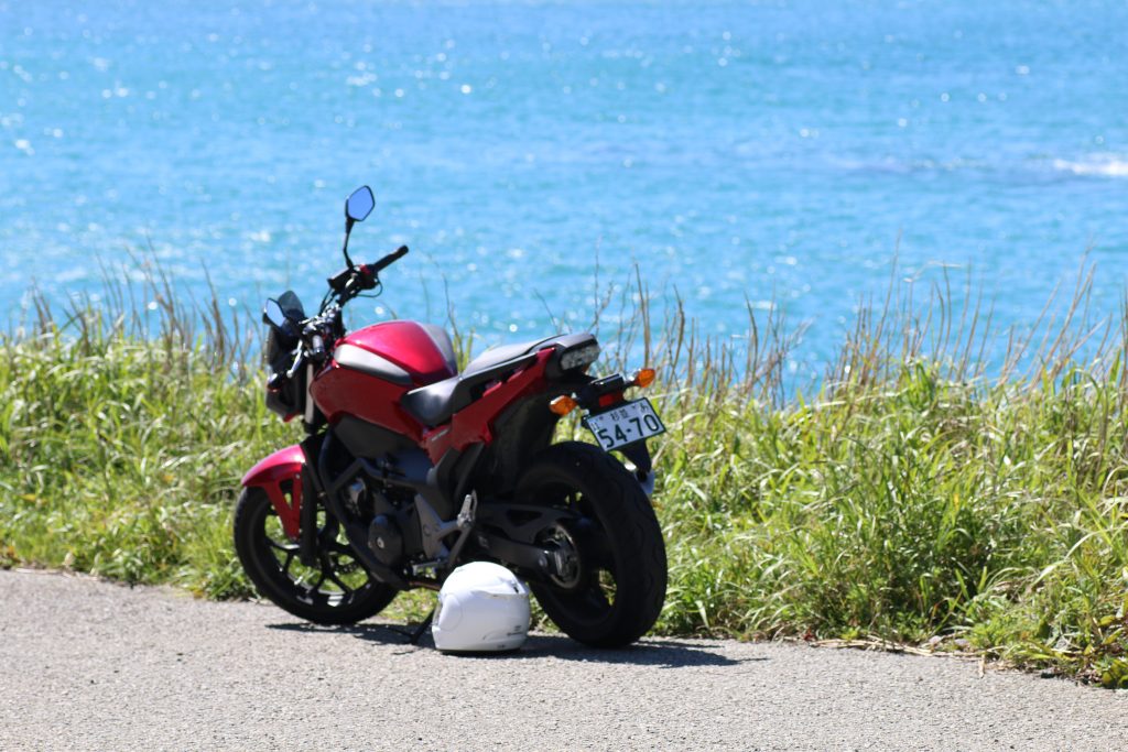
NC750Sと海
なんとなくノスタルジックなNC750Sと海

And one more photo. This is one of the best which has nostalgic atmosphere. I have enough time to head another site, but I return home to avoid the traffic jam which often occurs between Tokyo and Chiba.

« Older posts