ダムや海、山、川、岬を巡るツーリングを通し関東を主に日本の風景を紹介します

Month: June 2020

Solo-touring on the Route 140 from the FRUIT LINE to HIROSE Dam and CHIHIBU

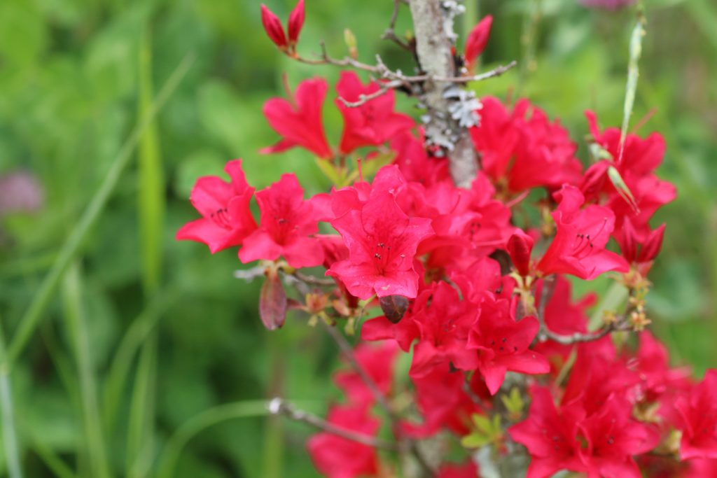
The both side of the FRUIT LINE was full of young fruit

Someday, I rode for a solo touring from OKUTAMA to KOSHU and through the FRUIT LINE to CHICHIBU on the Route 140. It is said that the longest novel in Japan is ‘DAIBOSATSUTOGE’ and I found the sign says ‘DAIBOSATSUTOGE’ on the way from OKUTAMA to KOSHU. But I did not take the way and rode for the FRUIT LINE.

フルーツラインの看板
フルーツラインの周りはその名の通りブドウ、モモの果樹園がです

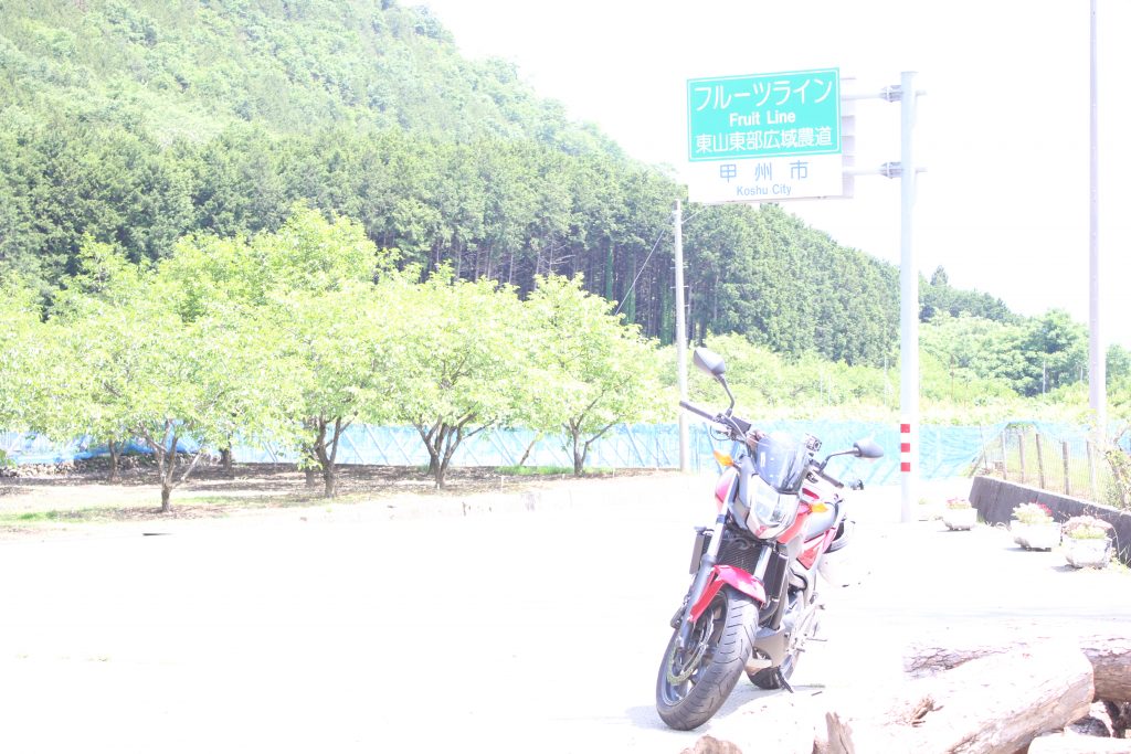
I took some photos in front of the fruit field beside the FRUIT LINE … I made a mistake of the setting of the camera. As the result, the photo is too bright. In this season, on the fruit fields beside the FRUIT LINE young grapes and peaches are growing.

ブドウの芽と極若い実
ブドウの極若い実がついていました。

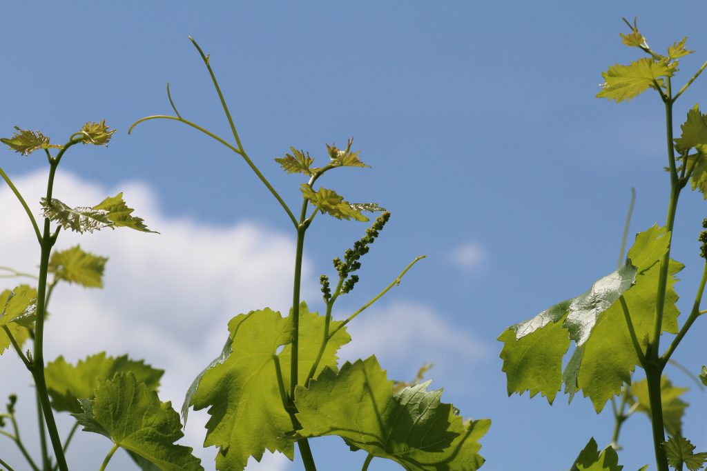
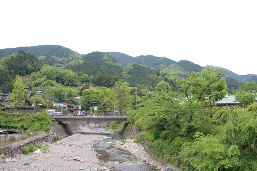
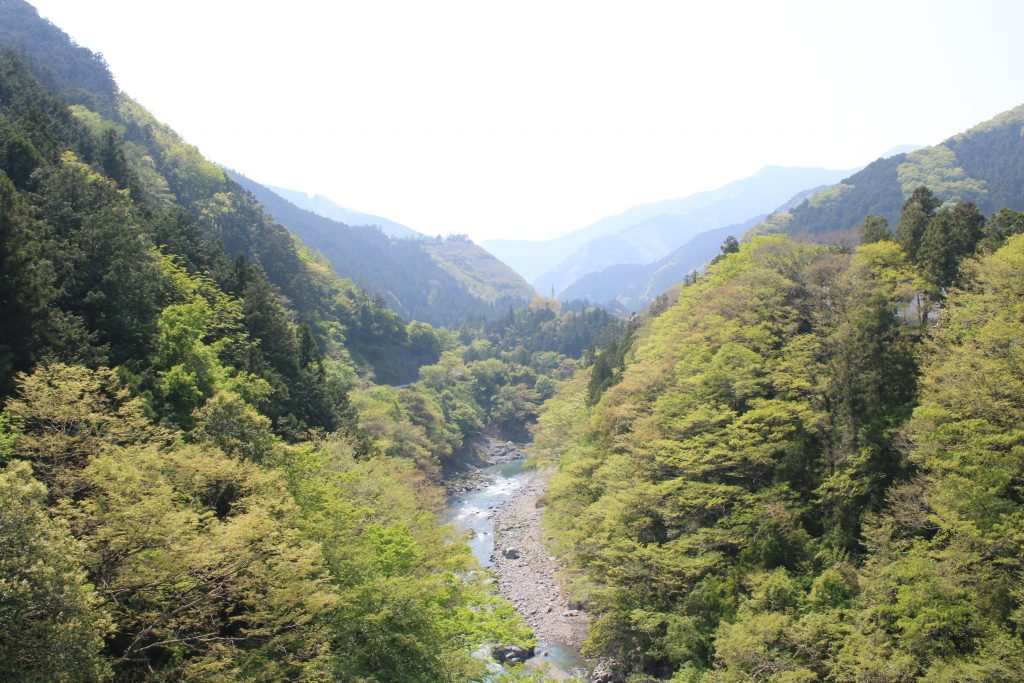
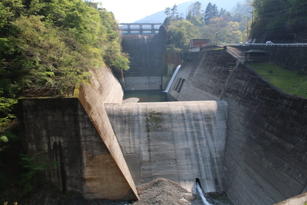
The sight leafs and ivies of grapes grows into the sky remind me that it is early summer. A pleasure winding road continues from the FRUIT LINE to the Route 140. After riding the winding road, I found the dam body on my left hand side. I took a rest at the dam, HIROSE Dam. A multi purpose dam that YAMANASHI Pref. built and administrates.

The dam body of HIROSE Dam can be seen from the Route 140

  • 広瀬ダムの看板
    広瀬ダムの看板です
  • 広瀬湖全景
    ロックフィルダムのダム堤体と水+山々のコントラストは絵になります
  • 広瀬ダム下流側の堤体
    下流側のダム堤体は国道140号から見えます。
  • 広瀬ダムの横越流堤
    広瀬ダムは洪水吐に加えて側面に越流堤があるのが特徴です

HIROSE dam plays roles of the flood control, the irrigation, the waterworks and the power generation. The most important motivation of the dam is mainly the flood control. Down stream area of FUEFUKI Riv. is a basin and floods often killed people and damaged the area in the past. They started building the dam in 1970’s and completed in 1980’s. The dam was the first multi purpose dam at the time. Now KOTOKAWA Dam on the same FUEFUKI Riv. system is a multi purpose dam, too.

Mt. BUKO welcame me at CHICHIBU beyond KARISAKA Tunnel

There is the tall gate beyond HIROSE Dam. National route is usually free in Japan and I looked for the charge free route… but I could not found. The free route of the Route 140 is a mountain trail famous as ‘CHICHIBU OUKAN ( CHICHIBU in-outbound). Of course no cars and no motorcycles can pass the route.
On the toll way of the Route 140, KARISAKA Tunnel lays. The length of the tunnel is 6652m and the longest ground tunnel among the national route in Japan. I paid 590 jpy. and rode through the long tunnel to a basin area, CHICHIBU.

武甲山の山容
非常に人工的である意味威容でもあります

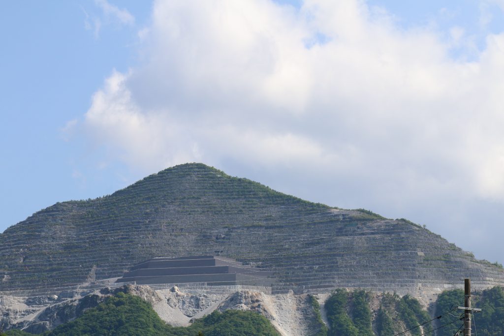
I could see the great Mt. BUKO. The mountain had been famous as the symbol of CHICHIBU until the early Meiji era. in Japan. From the middle Meiji era., the limestone mining was started and has been continued. As the result, the sight of the mountain became artificial as seen in the photo above. In KOCHI Pref., there is Mt. TORIGATA that has been curved as well. But I felt something stronger from Mt. BUKO, probably because Mt. BUKO can be seen easily from town area of CHICHIBU. ( Mt.TORIGATA can not be seen from town area. ) The mined limestone has been used as the ingredient of the concrete of buildings in the capital area.

I went home, after taking a rest at the Road Station ASHIGAKUBO and through CHICHIBU-OME line.

Azalea blossoms and swallows at the Road Station ASHIGAKUBO

The Road Station ASHIGAKUBO

Some day, I rode to the Road Station ASHIGAKUBO, CHICHIBU district for solo touring. The road station is beside of the route 299 and in the front of CHICHIBU city from SAITAMA city. Around there is the last mountainous area from the mountains in the western SAITAMA to the CHICHIBU Basin.

道の駅芦ヶ久保の荒川水系
奥が上流 右奥に見えているのが道の駅の建物

Beyond the mountains in the picture is direction to SAITAMA City, and the route 299 stretches in the mountains. The name of the stream is not known but it is one of the upstream of ARAKAWA River. This stream flows west once and reaches the CHICHIBU Basin. And the stream is gathered by ARAKAWA River, flows north to NAGATORO and flows east on the KANTO Plain.

Alpenroses fully blossomed

道の駅芦ヶ久保のヤマツツジ
ツツジには詳しくありませんが恐らくヤマツツジと思われます

In this season, late spring, alpenroses fully blossomed around the mountain. Though they are very beautiful, the color of flash pink remind me an overwrought passion. And hard looking at the striking pistils and stamens seems to lead me to the world in the flower.

Swallows start the building their nest

道の駅芦ヶ久保で出会った燕の急旋回
たまたま撮影できたツバメの急旋回

Many swallows flew around. The photo above is luckily taken at the moment of the rapid turn by a swallow. Do not think the pose of the swallow is like a scene in a Japanese kabuki?

道の駅芦ヶ久保で出会った燕の顔
黒と白と思われているツバメの顔は意外と明るい褐色

The image of swallows are the black body and the white belly. Do you remember their face? Their face is light brown. Have you ever noticed this? They are starting building the nest and were flying to find the place where the nest would be built. I said to good bye to the swallows in the Road Station ASHIGAKUBO, and go home via metro road 53, OME-CHICHIBU line.

The beautiful landscape of a yellow green valley and wild cherries at OKUTAMA in late spring

Someday, I went for solo touring to OKUTAMA. It was a late spring day and the landscape of a yellow green on a valley and mountains was impressive.

秋川と奥多摩の山々
晩春の芽吹きの萌黄色が印象的です

The river in the picture is AKIGAWA River and the mountains in OKUTAMA can be seen beyond the valley. The valley was beautiful and at the same time the landscape that the mountains overlap each other were impressive. I rode on the route 411 for OKUTAMA and I could see OGOCHI Dam in my left hand side.

小河内ダムの洪水吐
小河内ダムを国道411号線から

From the route 411, the emergency channel of OGOCHI Dam was seen nearly. It was so large that the photo above does not express the scale of the dam. Once I rode beyond OGOCHI Dam, I reached the lake side of OKUTAMA Lake. I found the wild cherries blossom.

名残のヤマザクラ
晩春、奥多摩名残のヤマザクラ

After I had been satisfied with the yellow green landscape and the wild cherries blossom, I returned home.